IMAGES TAKEN NEAR TO
Lime Walk, BURY ST. EDMUNDS, IP32 7PX

Introduction

This page details the photographs taken nearby to Lime Walk, IP32 7PX by members of the Geograph project.

The Geograph project started in 2005 with the aim of publishing, organising and preserving representative images for every square kilometre of Great Britain, Ireland and the Isle of Man.

There are currently over 7.5m images from over14,400 individuals and you can help contribute to the project by visiting https://www.geograph.org.uk

Image Map


Images are licensed for reuse under creativecommons.org/licenses/by-sa/2.0
Notes
  • Clicking on the map will re-center to the selected point.
  • The higher the marker number, the further away the image location is from the centre of the postcode.

Image Listing (29 Images Found)

Images are licensed for reuse under creativecommons.org/licenses/by-sa/2.0
  • ...
Image
Details
Distance
1
Airfield Road, Moreton Hall
Moreton Hall is a major, ongoing, expansion of Bury St. Edmunds.
Image: © Hugh Venables Taken: 22 Dec 2016
0.07 miles
2
Roundabout, Moreton Hall
Image: © Hugh Venables Taken: 22 Dec 2016
0.10 miles
3
Roundabout on Mount Road, Bury St Edmunds
Image: © JThomas Taken: 14 Sep 2015
0.10 miles
4
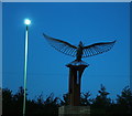
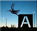
Roundabout sculpture, airfield memorial
This sculpture is featured on the roundabout at the junction of the old Mount Road (Bury St. Edmunds to Thurston Road) and the new Lady Miriam Way. It is a memorial for the US airmen that died operating from Rougham Airfield in World War Two - its location is on the edge of that airfield. The sculpture represents the dove of peace on top of a section of B17 aircraft tailplane. This shows the letter A, as worn by the bombers from the airfield. There are other views of the sculpture at Image and Image
Image: © John Goldsmith Taken: 2 Oct 2016
0.10 miles
5
Memorial sculpture on roundabout
This sculpture is featured on the roundabout at the junction of the old Mount Road (Bury St. Edmunds to Thurston Road) and the new Lady Miriam Way. It is a memorial for the US airmen that died operating from Rougham Airfield in World War Two - its location is on the edge of that airfield. The sculpture represents the dove of peace with a section of B17 aircraft tailplane. This shows the letter A, as worn by the bombers from the airfield. It has become a favourite spot for photographing the sunset. There are other views of the sculpture at Image and Image
Image: © John Goldsmith Taken: 2 Oct 2016
0.10 miles
6
Airfield memorial sculpture on roundabout
This sculpture is featured on the roundabout at the junction of the old Mount Road (Bury St. Edmunds to Thurston Road) and the new Lady Miriam Way. It is a memorial for the US airmen that died operating from Rougham Airfield in World War Two - its location is on the edge of that airfield. Bury St. Edmunds has a tradition of sculptures on the roundabouts. The sculpture represents the dove of peace on top of a section of B17 aircraft tailplane. This shows the letter A, as worn by the bombers from the airfield. The whole sculpture sits atop a brick plinth in the centre of the landscaped roundabout. Houses on the Moreton Hall estate are visible to the rear. Moreton Hall (named after a local mansion) has a claim to fame, as its inhabitants have the greatest age at death of any place in the UK. There are other views of the sculpture at Image and Image
Image: © John Goldsmith Taken: 27 Oct 2016
0.10 miles
7
National Cycle Route 13
Heading east beside Mount Road, Bury St Edmunds.
Image: © JThomas Taken: 14 Sep 2015
0.11 miles
8
House on Mount Road, Bury St Edmunds
Image: © JThomas Taken: 14 Sep 2015
0.11 miles
9
The Flying Fortress, near Bury St Edmunds
This public house, at the end of a short lane, used to be 'in the sticks' a couple of miles outside the town. But modern housing development has now reached it and threatens to swallow it up. in the next few years.
Image: © Bob Jones Taken: 5 Jul 2005
0.12 miles
10
The Flying Fortress Pub
The Flying Fortress pub that was a farm house on the wartime airfield U.S.A.A.F. Rougham, Suffolk. For info on the airfield see http://en.wikipedia.org/wiki/RAF_Bury_St_Edmunds and for a close up view of the pub sign see http://www.geograph.org.uk/photo/1293867
Image: © Keith Evans Taken: 8 May 2009
0.14 miles
  • ...