IMAGES TAKEN NEAR TO
Wagtail Drive, BURY ST. EDMUNDS, IP32 7GP
Introduction
This page details the photographs taken nearby to Wagtail Drive, IP32 7GP by members of the Geograph project.
The Geograph project started in 2005 with the aim of publishing, organising and preserving representative images for every square kilometre of Great Britain, Ireland and the Isle of Man.

There are currently over 7.5m images from over14,400 individuals and you can help contribute to the project by visiting https://www.geograph.org.uk
Image Map
Images are licensed for reuse under creativecommons.org/licenses/by-sa/2.0
Notes
- Clicking on the map will re-center to the selected point.
- The higher the marker number, the further away the image location is from the centre of the postcode.
Image Listing (13 Images Found)
Images are licensed for reuse under creativecommons.org/licenses/by-sa/2.0
Image
Details
Distance
1
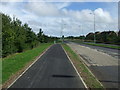
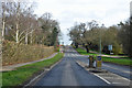
National Cycle Route 13
Heading east beside Mount Road, Bury St Edmunds.
Image: © JThomas
Taken: 14 Sep 2015
0.11 miles
4
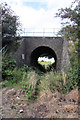
Railway bridge at Cattishall
The old track through the railway arch cannot be accessed, due to a high wire fence at the edge of a modern housing estate.
Image: © Bob Jones
Taken: 19 Aug 2008
0.13 miles
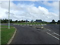
5
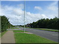
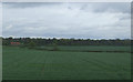
Mount Road, Bury St Edmunds
A principal road in an area of fairly recent development extending the old town to the east.
Image: © Robin Webster
Taken: 7 Mar 2020
0.21 miles
6
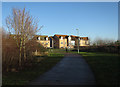
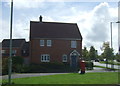
Moreton Hall
A major, ongoing, expansion of Bury St. Edmunds.
Image: © Hugh Venables
Taken: 22 Dec 2016
0.22 miles
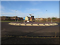
10
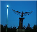
Roundabout sculpture, airfield memorial
This sculpture is featured on the roundabout at the junction of the old Mount Road (Bury St. Edmunds to Thurston Road) and the new Lady Miriam Way. It is a memorial for the US airmen that died operating from Rougham Airfield in World War Two - its location is on the edge of that airfield.
The sculpture represents the dove of peace on top of a section of B17 aircraft tailplane. This shows the letter A, as worn by the bombers from the airfield.
There are other views of the sculpture at Image and Image
Image: © John Goldsmith
Taken: 2 Oct 2016
0.23 miles