IMAGES TAKEN NEAR TO
Wilbur Close, BURY ST. EDMUNDS, IP32 7FD
Introduction
This page details the photographs taken nearby to Wilbur Close, IP32 7FD by members of the Geograph project.
The Geograph project started in 2005 with the aim of publishing, organising and preserving representative images for every square kilometre of Great Britain, Ireland and the Isle of Man.

There are currently over 7.5m images from over14,400 individuals and you can help contribute to the project by visiting https://www.geograph.org.uk
Image Map
Images are licensed for reuse under creativecommons.org/licenses/by-sa/2.0
Notes
- Clicking on the map will re-center to the selected point.
- The higher the marker number, the further away the image location is from the centre of the postcode.
Image Listing (30 Images Found)
Images are licensed for reuse under creativecommons.org/licenses/by-sa/2.0
Image
Details
Distance
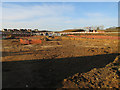
1
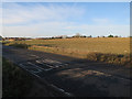
Field to be built on
Moreton Hall is a major, ongoing, expansion of Bury St. Edmunds.
Image: © Hugh Venables
Taken: 22 Dec 2016
0.04 miles
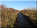
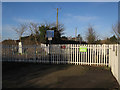
2
Cycle route across the railway
With Moreton Hall development ongoing.
Image: © Hugh Venables
Taken: 22 Dec 2016
0.04 miles
3
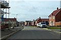
Shackeroo Road, Bury St Edmunds
At the eastern limit, so far, of the new development extending the town to the east. The theme for road names in this latest area of building is the informal naming applied to USAAF bombers that flew from Bury St Edmunds (Rougham) airfield.
Image: © Robin Webster
Taken: 7 Mar 2020
0.06 miles
4
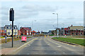
Roundabout on Mount Road, Bury St Edmunds
At the eastern limit, so far, of the new development extending the town to the east.
Image: © Robin Webster
Taken: 7 Mar 2020
0.06 miles
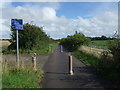
5
National cycle route 51
Between Bury St. Edmunds and Thurston.
Image: © Hugh Venables
Taken: 22 Dec 2016
0.06 miles
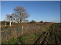
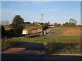
10
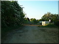
Cattishall Level Crossing
The now close to motor traffic level crossing at Cattishall near to Bury St.Edmunds.
Image: © Keith Evans
Taken: 8 May 2009
0.10 miles