
IMAGES TAKEN NEAR TO
Kembold Close, BURY ST. EDMUNDS, IP32 7EF
Introduction
This page details the photographs taken nearby to Kembold Close, IP32 7EF by members of the Geograph project.
The Geograph project started in 2005 with the aim of publishing, organising and preserving representative images for every square kilometre of Great Britain, Ireland and the Isle of Man.

There are currently over 7.5m images from over14,400 individuals and you can help contribute to the project by visiting https://www.geograph.org.uk
Image Map
Images are licensed for reuse under creativecommons.org/licenses/by-sa/2.0
Notes
- Clicking on the map will re-center to the selected point.
- The higher the marker number, the further away the image location is from the centre of the postcode.
Image Listing (21 Images Found)
Images are licensed for reuse under creativecommons.org/licenses/by-sa/2.0
Image
Details
Distance
1
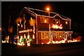
House decorated with Christmas lights at Moreton Hall
This house, in Kembold Close, was lit up for Christmas in aid of a local charity.
Image: © David Ayrton
Taken: 25 Dec 2008
0.01 miles
2
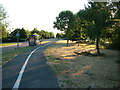
Road, footpath and cycleway
Looking west on Symonds Road, Moreton Hall estate, Bury St. Edmunds. This estate has been the main growth area for Bury St. Edmunds for the last 20 years, though this is one of the oldest roads.
Image: © John Goldsmith
Taken: 21 Jul 2010
0.06 miles
3
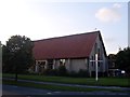
Christ Church Moreton Hall
Founded by the Christian denominations of Bury St Edmunds in 1985.
Image: © Stuart Shepherd
Taken: 21 Mar 2008
0.06 miles
4
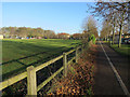
National cycle route 51
By Symonds Road, Bury St. Edmunds.
Image: © Hugh Venables
Taken: 22 Dec 2016
0.06 miles
5
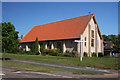
Christ Church, Moreton Hall Estate
This church, built in 1985, serves the ever-growing housing estate at Moreton Hall, Bury St Edmunds. http://www.ccmh.org.uk
Image: © Bob Jones
Taken: 21 May 2010
0.07 miles
6
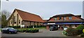
Christ Church and Tesco Express, off Symonds Road, Bury St Edmunds
Image: © Christopher Hilton
Taken: 8 Apr 2024
0.07 miles
7
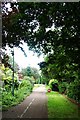
Path and cycle-way
Track near Pond Covert
Image: © John Myers
Taken: 23 Jun 2012
0.08 miles
8
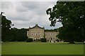
Moreton Hall School
A private school in Bury St Edmunds
Image: © Bob Jones
Taken: 1 Jul 2005
0.09 miles
9
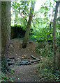
Second B17 crash pit in Home Covert
See Image for more details.
I wonder if the householders realise what happened at the bottom of their gardens 65 years ago.
Image: © John Goldsmith
Taken: 21 Jul 2010
0.09 miles
10
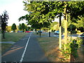
Moreton Hall road, footpath and cycle path
Past the church, out of sight on the left, we view down to the roundabout. The converging cars on the right are heading towards one of the raised road features combined with a pedestrian crossing. This road is inflicted with left right swerves as well as these bumps, all so-called traffic calming - they don't calm me.
Image: © John Goldsmith
Taken: 21 Jul 2010
0.10 miles