
IMAGES TAKEN NEAR TO
Raedwald Drive, BURY ST. EDMUNDS, IP32 7DA
Introduction
This page details the photographs taken nearby to Raedwald Drive, IP32 7DA by members of the Geograph project.
The Geograph project started in 2005 with the aim of publishing, organising and preserving representative images for every square kilometre of Great Britain, Ireland and the Isle of Man.

There are currently over 7.5m images from over14,400 individuals and you can help contribute to the project by visiting https://www.geograph.org.uk
Image Map
Images are licensed for reuse under creativecommons.org/licenses/by-sa/2.0
Notes
- Clicking on the map will re-center to the selected point.
- The higher the marker number, the further away the image location is from the centre of the postcode.
Image Listing (17 Images Found)
Images are licensed for reuse under creativecommons.org/licenses/by-sa/2.0
Image
Details
Distance
1
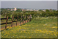
Paddock at Moreton Hall Preparatory School
The paddock to the left of the fence is situated in the south-west corner of the playing fields in front of Moreton Hall Preparatory School. In the distance, the tower of St Edmundsbury Cathedral can be seen, and behind that, the water tower in West Road, Bury St Edmunds.
Image: © Bob Jones
Taken: 21 May 2010
0.09 miles
2
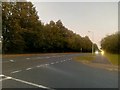
Junction of Symonds Road and Raedwald Avenue, Bury St. Edmunds
Symonds Road is one of the major roads through a large new residential area on the east side of Bury St Edmunds.
Image: © Christopher Hilton
Taken: 18 Sep 2019
0.10 miles
3
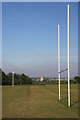
Rugby posts at Moreton Hall Preparatory School
There are two rugby pitches in front of the school. In the distance, the tower of the St Edmundsbury cathedral can be seen.
Image: © Bob Jones
Taken: 21 May 2010
0.16 miles
4
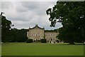
Moreton Hall School
A private school in Bury St Edmunds
Image: © Bob Jones
Taken: 1 Jul 2005
0.17 miles
5
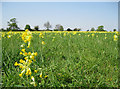
Cowslip carpet
This meadow west of Moreton Hall Preparatory School is covered with cowslips at this time of year. Permissive paths have been provided around this field.
Image: © Bob Jones
Taken: 19 Apr 2011
0.17 miles
6
Path and cycle-way
Track near Pond Covert
Image: © John Myers
Taken: 23 Jun 2012
0.18 miles
7
Symonds Road, Bury St Edmunds
A principal road in an area of fairly recent development extending the old town to the east.
Image: © Robin Webster
Taken: 7 Mar 2020
0.18 miles
8
Bus stop
Bus stop Symonds Road Bury St.Edmunds Suffolk.
Image: © Keith Evans
Taken: 31 May 2008
0.21 miles
9
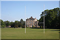
Moreton Hall Preparatory School
This school occupies a fine Palladian mansion built by the architect Robert Adam in 1773. The house is Grade 2* listed and visitors are welcome for tours by costumed guides during Heritage Open Days. The school http://www.moretonhall.net sits in 30 acres of parkland, which includes playing fields with cricket and rugby pitches.
Image: © Bob Jones
Taken: 21 May 2010
0.21 miles
10
Path from Layhill Covert
Exit to Bedingfield Way
Image: © John Myers
Taken: 23 Jun 2012
0.22 miles