1
Narrow path to Hollow Road, Bury St Edmunds
Image: © Evelyn Simak
Taken: 31 Aug 2010
0.01 miles
2
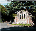
The ruins of the Hospital of St. Nicholas in Hollow Road
This picture shows the ruined walls of what was once the Hospital of St. Nicholas.
Image: © Robert Edwards
Taken: 15 Aug 2007
0.01 miles
3
Flower seller's bike?
I don't think so, but it does make an attractive way of showing flowers.
Image: © Adrian S Pye
Taken: 31 Aug 2010
0.01 miles
4
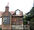
St Nicholas' House, Bury St Edmunds
This old house is situated in Hollow Road and adjoins the ruins of St Nicholas' hospital > http://www.geograph.org.uk/photo/2044091.
Image: © Evelyn Simak
Taken: 31 Aug 2010
0.02 miles
5
Part of the Hospital of St. Nicholas
These ruins belong to the Hospital of St. Nicholas, one of five hospitals that once stood in Bury during the time before the abbey was destroyed. The actual window in this ruin, is said to have originally come from the former Leper Hospital of St. Petronilla.
Image: © Robert Edwards
Taken: 15 Aug 2007
0.02 miles
6
Bury St Edmunds houses [301]
St Nicholas, number 2 Hollow Road is a house built on the site of the former Hospital of St Nicholas and incorporating fragments of it. The oldest parts are late 15th century but most of the building is from the 17th, 18th and 19th centuries. The house is partly timber-framed and stuccoed, partly with exposed timbering and brick nogging and partly red brick. Listed, grade II*, with details at: https://historicengland.org.uk/listing/the-list/list-entry/1022540
Until the second half of the 20th century, there were almost no buildings east of the River Lark except along Eastgate Street which has a number of 16th and 17th century houses. Now there are several large housing estates and a fairly large industrial estate.
Bury St Edmunds is a market town which is the cultural and retail centre for West Suffolk and is known for brewing (Greene King) and sugar (British Sugar). There is scattered evidence of earlier activity but essentially Bury St Edmunds began as one of the royal boroughs of the Saxons and a monastery was founded which became the burial place of King Edmund. A new Benedictine abbey was built in 1020 which became rich and powerful and the town was laid out on a grid pattern by Abbot Baldwin. After the dissolution the abbey became ruinous. A new church, later the cathedral, was begun in the early 16th century.
Image: © Michael Dibb
Taken: 8 Sep 2020
0.02 miles
7
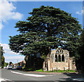
The ruined St Nicholas' hospital, Bury St Edmunds
It is adjoined by St Nicholas' House > http://www.geograph.org.uk/photo/2044082. The south wall with a window that is believed to have come from St Petronilla's church sits in the fork formed by Hollow Road (at right) and Barton Road.
Founded by an unknown abbot of Bury St Edmunds, the hospital of St. Nicholas was situated just outside the east gate. It consisted of a master, a chaplain, and several brethren. The earliest known dated reference to it is of the year 1224, when Henry III granted a fair to the master of the hospital of St. Nicholas, to be held on the feast and vigil of the Translation of St. Nicholas.
Image: © Evelyn Simak
Taken: 31 Aug 2010
0.02 miles
8
The ruined St Nicholas' hospital, Bury St Edmunds
It is adjoined by St Nicholas' House > http://www.geograph.org.uk/photo/2044082. The south wall with a window that is believed to have come from St Petronilla's church sits in the fork formed by Hollow Road (at left) and Barton Road.
Founded by an unknown abbot of Bury St Edmunds, the hospital of St. Nicholas was situated just outside the east gate. It consisted of a master, a chaplain, and several brethren. The earliest known dated reference to it is of the year 1224, when Henry III granted a fair to the master of the hospital of St. Nicholas, to be held on the feast and vigil of the Translation of St. Nicholas.
Image: © Evelyn Simak
Taken: 31 Aug 2010
0.02 miles
9
Industrial units west of Hollow Road, Bury St Edmunds
Image: © Evelyn Simak
Taken: 31 Aug 2010
0.03 miles
10
St Nicholas' House, Bury St Edmunds (detail)
This old house is situated in Hollow Road and adjoins the ruins of St Nicholas' hospital. For a full view see > http://www.geograph.org.uk/photo/2044082.
Image: © Evelyn Simak
Taken: 31 Aug 2010
0.03 miles


![Bury St Edmunds houses [301]](https://s3.geograph.org.uk/geophotos/06/69/66/6696623_05a6967d_120x120.jpg)


