IMAGES TAKEN NEAR TO
Thompson Walk, BURY ST. EDMUNDS, IP32 6PT
Introduction
This page details the photographs taken nearby to Thompson Walk, IP32 6PT by members of the Geograph project.
The Geograph project started in 2005 with the aim of publishing, organising and preserving representative images for every square kilometre of Great Britain, Ireland and the Isle of Man.

There are currently over 7.5m images from over14,400 individuals and you can help contribute to the project by visiting https://www.geograph.org.uk
Image Map
Images are licensed for reuse under creativecommons.org/licenses/by-sa/2.0
Notes
- Clicking on the map will re-center to the selected point.
- The higher the marker number, the further away the image location is from the centre of the postcode.
Image Listing (22 Images Found)
Images are licensed for reuse under creativecommons.org/licenses/by-sa/2.0
Image
Details
Distance
2

Bury St Edmunds Golf Course
Looking north west across the course, from the western edge of the Howard Estate.
Image: © Bob Jones
Taken: 22 Jun 2005
0.18 miles
3

Rooftop view of Howard Estate
Beyond the AMOT rooftop the row of trees hides the railway and the A14 road. Beyond that the sun glints on the houses of the Howard Estate, built by the council in the 1960s largely to house workers moving from London as part of the overspill project. The large white building on the right is the Goods In facility of W Vinten, one of the pioneering companies that moved from London.
Unusually, there are no aircraft in the sky - much of the time there will be a Hercules, some other transport aircraft, a radar equipped 707, or a KC135 tanker, descending from right to left as they approach the Mildenhall runway.
This is a two photo panorama.
Image: © John Goldsmith
Taken: 6 Oct 2008
0.19 miles
5
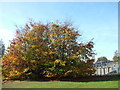
Autumnal scene by bridges
On the right of the picture we see a bus on a bridge, it seems. In reality the bridge you can see is a two track railway bridge and there is a small gap before the road bridge that carries the A14 dual carriageway and the bus. Underneath both bridges runs Beeton's Way, a local road. Ideally I suppose the bridges would be one structure but the railway bridge was built in the mid 1960s, several years before the 1971 road bridge. The road was the A45 at the time, and took the traffic that formerly ran through the town.
These trees have the full set of autumn colours - green, yellow and red.
Image: © John Goldsmith
Taken: 2 Nov 2011
0.20 miles
6
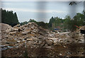
Pioneer Store gone
Compare with the first stage of demolition Image and then the tower going Image No building now left, just rubble. ASDA store to be open in spring 2009.
Apologies for the artefacts on the photo, resulting from close mesh fencing, even across the fence peephole supplied.
Can anyone explain the narrow horizontal banding?
Image: © John Goldsmith
Taken: 9 Sep 2008
0.21 miles
7
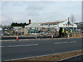
Revealed, premises next to Asda site
This building has been largely hidden from view by adjacent buildings for decades, firstly when it was a sweet factory and more recently as a office supplies warehouse etc. In the foreground a gang is completing the new pavement. The plans showed a new office block in this area but it looks as if that might not happen now.
Image: © John Goldsmith
Taken: 13 Mar 2009
0.21 miles
9
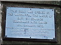
Road opening plaque
Plaque to mark the opening of Beetons way the road and rail bridge for photo of the bridges see http://www.geograph.org.uk/photo/625484
Image: © Keith Evans
Taken: 2 Dec 2007
0.22 miles