
IMAGES TAKEN NEAR TO
Salmon Walk, BURY ST. EDMUNDS, IP32 6PS
Introduction
This page details the photographs taken nearby to Salmon Walk, IP32 6PS by members of the Geograph project.
The Geograph project started in 2005 with the aim of publishing, organising and preserving representative images for every square kilometre of Great Britain, Ireland and the Isle of Man.

There are currently over 7.5m images from over14,400 individuals and you can help contribute to the project by visiting https://www.geograph.org.uk
Image Map
Images are licensed for reuse under creativecommons.org/licenses/by-sa/2.0
Notes
- Clicking on the map will re-center to the selected point.
- The higher the marker number, the further away the image location is from the centre of the postcode.
Image Listing (42 Images Found)
Images are licensed for reuse under creativecommons.org/licenses/by-sa/2.0
Image
Details
Distance
2
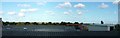
Rooftop view of Howard Estate
Beyond the AMOT rooftop the row of trees hides the railway and the A14 road. Beyond that the sun glints on the houses of the Howard Estate, built by the council in the 1960s largely to house workers moving from London as part of the overspill project. The large white building on the right is the Goods In facility of W Vinten, one of the pioneering companies that moved from London.
Unusually, there are no aircraft in the sky - much of the time there will be a Hercules, some other transport aircraft, a radar equipped 707, or a KC135 tanker, descending from right to left as they approach the Mildenhall runway.
This is a two photo panorama.
Image: © John Goldsmith
Taken: 6 Oct 2008
0.16 miles
3
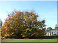
Autumnal scene by bridges
On the right of the picture we see a bus on a bridge, it seems. In reality the bridge you can see is a two track railway bridge and there is a small gap before the road bridge that carries the A14 dual carriageway and the bus. Underneath both bridges runs Beeton's Way, a local road. Ideally I suppose the bridges would be one structure but the railway bridge was built in the mid 1960s, several years before the 1971 road bridge. The road was the A45 at the time, and took the traffic that formerly ran through the town.
These trees have the full set of autumn colours - green, yellow and red.
Image: © John Goldsmith
Taken: 2 Nov 2011
0.16 miles
5
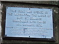
Road opening plaque
Plaque to mark the opening of Beetons way the road and rail bridge for photo of the bridges see http://www.geograph.org.uk/photo/625484
Image: © Keith Evans
Taken: 2 Dec 2007
0.18 miles
6
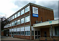
William Vinten House
Since I last photographed this 1960s office block it has gained a name from its founder and a large new sign, celebrating 100 years of the company. Strange that the sign boldly says Vinten when the company is now called Camera Dynamics - it must cause much confusion to visitors and deliveries.
Image: © John Goldsmith
Taken: 18 Jun 2010
0.19 miles
7
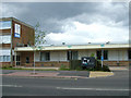
New sign at Vinten/Camera Dynamics
A new sign advertising Vitec Group Videocom Division has been added to the front of the Camera Dynamics premises. Not sure exactly what Videocom do - their website is full of waffle.
Image: © John Goldsmith
Taken: 30 May 2010
0.19 miles
8
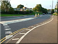
Beeton's Way, Bury St. Edmunds
Until the late 1960s this was a footpath, with a gated crossing over the railway track. It became a road, with a bridge carrying the railway above, then later the A45 road (now A14) was built alongside the line. On the left the old Vinten canteen building is now leased by an aerospace camera maintenance company.
Before the mini-roundabout to Western Way was added on the left, this corner was a regular scene of accidents as an optical illusion gave the impression the road went straight on.
Image: © John Goldsmith
Taken: 16 Sep 2008
0.19 miles
9
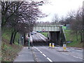
Road and rail bridge
The road and rail crossing Beetons way Bury St.Edmunds Suffolk. The bridge nearest the camera is the railway line and just behind is the road bridge carrying the A14. See http://www.geograph.org.uk/photo/625491 for info plaque.
Image: © Keith Evans
Taken: 2 Dec 2007
0.19 miles
10

Trees reflect on sign, near sunset
A sign on the AMOT office block in Western Way.
The sign has special dispensation to be chrome - the corporate guide says it should be blue.
For more details seeImage
Image: © John Goldsmith
Taken: 16 Sep 2008
0.19 miles