
IMAGES TAKEN NEAR TO
Deck Walk, BURY ST. EDMUNDS, IP32 6PG
Introduction
This page details the photographs taken nearby to Deck Walk, IP32 6PG by members of the Geograph project.
The Geograph project started in 2005 with the aim of publishing, organising and preserving representative images for every square kilometre of Great Britain, Ireland and the Isle of Man.

There are currently over 7.5m images from over14,400 individuals and you can help contribute to the project by visiting https://www.geograph.org.uk
Image Map
Images are licensed for reuse under creativecommons.org/licenses/by-sa/2.0
Notes
- Clicking on the map will re-center to the selected point.
- The higher the marker number, the further away the image location is from the centre of the postcode.
Image Listing (16 Images Found)
Images are licensed for reuse under creativecommons.org/licenses/by-sa/2.0
Image
Details
Distance
3
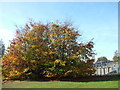
Autumnal scene by bridges
On the right of the picture we see a bus on a bridge, it seems. In reality the bridge you can see is a two track railway bridge and there is a small gap before the road bridge that carries the A14 dual carriageway and the bus. Underneath both bridges runs Beeton's Way, a local road. Ideally I suppose the bridges would be one structure but the railway bridge was built in the mid 1960s, several years before the 1971 road bridge. The road was the A45 at the time, and took the traffic that formerly ran through the town.
These trees have the full set of autumn colours - green, yellow and red.
Image: © John Goldsmith
Taken: 2 Nov 2011
0.19 miles
4
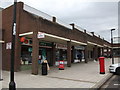
St.Olaves Shopping Precint
Local shops on St.Olaves Road Bury St.Edmunds, Suffolk.
Image: © Keith Evans
Taken: 18 Aug 2011
0.20 miles
5
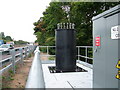
Gun mounting by A14?
This is part of the new government's secret plan to keep out unwanted immigrants, mounting anti-vehicle guns beside the A14 from Felixstowe. There is a cover story that they are installing new illuminated information signs.
Image: © John Goldsmith
Taken: 13 Jul 2010
0.20 miles
6
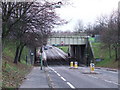
Road and rail bridge
The road and rail crossing Beetons way Bury St.Edmunds Suffolk. The bridge nearest the camera is the railway line and just behind is the road bridge carrying the A14. See http://www.geograph.org.uk/photo/625491 for info plaque.
Image: © Keith Evans
Taken: 2 Dec 2007
0.21 miles
7
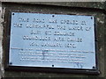
Road opening plaque
Plaque to mark the opening of Beetons way the road and rail bridge for photo of the bridges see http://www.geograph.org.uk/photo/625484
Image: © Keith Evans
Taken: 2 Dec 2007
0.21 miles
8
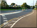
Beeton's Way, Bury St. Edmunds
Until the late 1960s this was a footpath, with a gated crossing over the railway track. It became a road, with a bridge carrying the railway above, then later the A45 road (now A14) was built alongside the line. On the left the old Vinten canteen building is now leased by an aerospace camera maintenance company.
Before the mini-roundabout to Western Way was added on the left, this corner was a regular scene of accidents as an optical illusion gave the impression the road went straight on.
Image: © John Goldsmith
Taken: 16 Sep 2008
0.22 miles
9
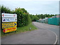
Branch off Anglian Lane
This little spur off Anglian Lane provides access to the back of CML (formerly Vitality Bulbs) and to the Warehouse Clearance shop, formerly Texas DIY. Also on the right is the back of a builders merchants.
The A14 dual carriageway runs past the end on an embankment - a little bit of crash barrier is just detectable between the trees.
Image: © John Goldsmith
Taken: 18 Jun 2010
0.23 miles
10
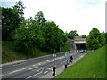
Beeton's Way railway bridge
Once upon a time a footpath led to a level crossing of the railway track. In the late 1960s a massive excavation (and works to deal with the resulting breach of an underground stream) produced this cutting allowing a road under the line, and a few years later for the road to also pass under the new A45 (now A14) road.
This is an unusual viewpoint from the top of the bank.
Image: © John Goldsmith
Taken: 30 May 2010
0.23 miles