
IMAGES TAKEN NEAR TO
Northgate Avenue, BURY ST. EDMUNDS, IP32 6DA
Introduction
This page details the photographs taken nearby to Northgate Avenue, IP32 6DA by members of the Geograph project.
The Geograph project started in 2005 with the aim of publishing, organising and preserving representative images for every square kilometre of Great Britain, Ireland and the Isle of Man.

There are currently over 7.5m images from over14,400 individuals and you can help contribute to the project by visiting https://www.geograph.org.uk
Image Map
Images are licensed for reuse under creativecommons.org/licenses/by-sa/2.0
Notes
- Clicking on the map will re-center to the selected point.
- The higher the marker number, the further away the image location is from the centre of the postcode.
Image Listing (61 Images Found)
Images are licensed for reuse under creativecommons.org/licenses/by-sa/2.0
Image
Details
Distance
1
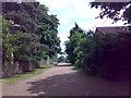
The Klondyke, eastern section
Here the roadway approaches Northgate Avenue
Image: © Carl Grove
Taken: 30 Jun 2013
0.03 miles
2
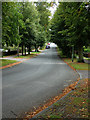
Northgate Avenue looking south
As part of the rectangular grid, this end of Northgate Avenue is approached from a dirt track leading from Tollgate Lane.
Image: © John Goldsmith
Taken: 21 Aug 2011
0.04 miles
4
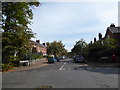
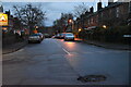
Looking from Northgate Road into Avenue Approach
Image: © Basher Eyre
Taken: 16 Sep 2018
0.06 miles
5
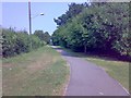
The Klondyke, central section
The grassy walkway which joins two rough-surfaced roadways
Image: © Carl Grove
Taken: 5 Jul 2013
0.06 miles
7
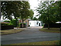
Surprising industrial estate
In the middle of a housing area we suddenly find this little industrial estate, at the corner of Northgate Avenue and Norfolk Road. The road deteriorates to a dirt track and leads through to Tollgate Lane, although pillars block cars and vans.
Image: © John Goldsmith
Taken: 6 Sep 2009
0.08 miles
8
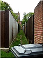
Narrow path leading to Northgate Avenue
One of the smaller parts of the rectangular grid that covers this part of Bury St. Edmunds.
Image: © John Goldsmith
Taken: 21 Aug 2011
0.09 miles
9
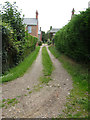
Dirt track to Avenue Approach
As part of the grid of roads and tracks in this part of town this track crosses the paved road Avenue Approach and continues the other side. This section seems well used and well maintained.
Image: © John Goldsmith
Taken: 21 Aug 2011
0.09 miles
10
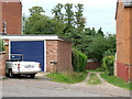
Dirt track off Avenue Approach plus classic car
A part of the rectangular grid in this part of Bury St. Edmunds, a further dirt track can be seen making a T junction at the end. This is the reverse view to Image
It's always a bonus to include a classic British car in the shot, such as this Triumph Herald convertible. But who installed such an awkward approach to the garage?
Image: © John Goldsmith
Taken: 21 Aug 2011
0.10 miles