
IMAGES TAKEN NEAR TO
Thurston, BURY ST. EDMUNDS, IP31 3SG
Introduction
This page details the photographs taken nearby to IP31 3SG by members of the Geograph project.
The Geograph project started in 2005 with the aim of publishing, organising and preserving representative images for every square kilometre of Great Britain, Ireland and the Isle of Man.

There are currently over 7.5m images from over14,400 individuals and you can help contribute to the project by visiting https://www.geograph.org.uk
Image Map
Images are licensed for reuse under creativecommons.org/licenses/by-sa/2.0
Notes
- Clicking on the map will re-center to the selected point.
- The higher the marker number, the further away the image location is from the centre of the postcode.
Image Listing (5 Images Found)
Images are licensed for reuse under creativecommons.org/licenses/by-sa/2.0
Image
Details
Distance
2
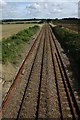
Railway line at Thurston
Looking eastwards from Grimwoods Bridge, near Grove Farm. The line is straight for nearly six kilometres between Thurston and Elmswell stations.
Image: © Bob Jones
Taken: 19 Sep 2006
0.22 miles
3

Peterborough bound train nr Grove farm
The railway runs in a very straight line and you can see a train approaching for a couple of miles here. Pictured is the lunchtime departure from Harwich Parkeston Quay to Peterborough. The trains formation is three coaches and a van. Typical of the service at that time. Mail and parcels would be loaded in the van. The next stop would be Bury St Edmunds then Ely. the corn on the right looks a bit patchy to say the least.
Image: © roger geach
Taken: 27 Apr 1986
0.23 miles
5
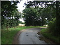
Sharp bend in Hollow Lane
Heading towards Tostock.
Image: © JThomas
Taken: 14 Sep 2015
0.24 miles