
IMAGES TAKEN NEAR TO
Walsham-le-Willows, BURY ST. EDMUNDS, IP31 3AS
Introduction
This page details the photographs taken nearby to IP31 3AS by members of the Geograph project.
The Geograph project started in 2005 with the aim of publishing, organising and preserving representative images for every square kilometre of Great Britain, Ireland and the Isle of Man.

There are currently over 7.5m images from over14,400 individuals and you can help contribute to the project by visiting https://www.geograph.org.uk
Image Map
Images are licensed for reuse under creativecommons.org/licenses/by-sa/2.0
Notes
- Clicking on the map will re-center to the selected point.
- The higher the marker number, the further away the image location is from the centre of the postcode.
Image Listing (4 Images Found)
Images are licensed for reuse under creativecommons.org/licenses/by-sa/2.0
Image
Details
Distance
1
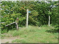
Footpath Sign
Footpath and sign off Reading's Lane near to Upthorpe, Suffolk.
Image: © Keith Evans
Taken: 7 Aug 2011
0.10 miles
2

Gravel loading at Shepherds Grove
This concrete pad beside the road is a leftover from the Shepherds Grove airfield. In the 1950s Sabre jets were positioned here for gun tests, firing shells into a huge earth mound, the edge of which is visible on the left.
The shingle being loaded here was being carried off to another field and its purpose was not clear.
Image: © John Goldsmith
Taken: 31 Jul 2009
0.12 miles

4
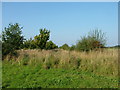
Former runway, Shepherds Grove airfield
The hedge and trees are planted on the course of the old main runway, and photographed on the SW end. Shepherds Grove airfield was built for the RAF in WW2 and used by the USAF in the cold war. It was a missile base for a while before turning into today's complex of industrial estates. Beware - the Google Earth images are seriously out of date: the tarmac runway has all gone.
Image: © John Goldsmith
Taken: 17 Sep 2008
0.24 miles