IMAGES TAKEN NEAR TO
Shepherds Grove Industrial Estate, BURY ST. EDMUNDS, IP31 2UD
Introduction
This page details the photographs taken nearby to Shepherds Grove Industrial Estate, IP31 2UD by members of the Geograph project.
The Geograph project started in 2005 with the aim of publishing, organising and preserving representative images for every square kilometre of Great Britain, Ireland and the Isle of Man.

There are currently over 7.5m images from over14,400 individuals and you can help contribute to the project by visiting https://www.geograph.org.uk
Image Map
Images are licensed for reuse under creativecommons.org/licenses/by-sa/2.0
Notes
- Clicking on the map will re-center to the selected point.
- The higher the marker number, the further away the image location is from the centre of the postcode.
Image Listing (6 Images Found)
Images are licensed for reuse under creativecommons.org/licenses/by-sa/2.0
Image
Details
Distance
1

Business Entrance
Entrance to Chesswood Produce near to Upthorpe, Suffolk.
Image: © Keith Evans
Taken: 7 Aug 2011
0.21 miles
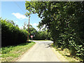
2
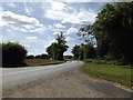
Summer Road, Upthorpe
At the junction with Chapel Road
Image: © Geographer
Taken: 9 Aug 2016
0.22 miles
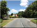
3
Summer Road, Upthorpe
At the junction with Chapel Road
Image: © Geographer
Taken: 9 Aug 2016
0.22 miles
4
Summer Road, Upthorpe
At the junction with Chapel Road
Image: © Geographer
Taken: 9 Aug 2016
0.22 miles
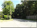
5
Chapel Road, Upthorpe
At the junction with Summer Road
Image: © Geographer
Taken: 9 Aug 2016
0.23 miles
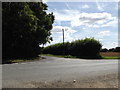
6
Chapel Road, Upthorpe
At the junction with Summer Road
Image: © Geographer
Taken: 9 Aug 2016
0.23 miles