IMAGES TAKEN NEAR TO
Ixworth, BURY ST. EDMUNDS, IP31 2JN
Introduction
This page details the photographs taken nearby to IP31 2JN by members of the Geograph project.
The Geograph project started in 2005 with the aim of publishing, organising and preserving representative images for every square kilometre of Great Britain, Ireland and the Isle of Man.

There are currently over 7.5m images from over14,400 individuals and you can help contribute to the project by visiting https://www.geograph.org.uk
Image Map
Images are licensed for reuse under creativecommons.org/licenses/by-sa/2.0
Notes
- Clicking on the map will re-center to the selected point.
- The higher the marker number, the further away the image location is from the centre of the postcode.
Image Listing (17 Images Found)
Images are licensed for reuse under creativecommons.org/licenses/by-sa/2.0
Image
Details
Distance
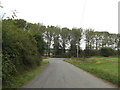
1
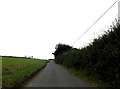
Heath Road, Ixworth
At the junction with the A1088 Thetford Road
Image: © Geographer
Taken: 19 Sep 2016
0.06 miles
2
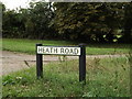
Heath Road sign
On Heath Road at the junction with the A1088 Thetford Road
Image: © Geographer
Taken: 6 Sep 2016
0.09 miles
3
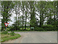
Thetford Road (A1088) junction at Ixworth
Image: © Adrian S Pye
Taken: 26 May 2015
0.09 miles
4
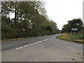
A1088 Thetford Road, Ixworth
At the junction with Heath Road
Image: © Geographer
Taken: 19 Sep 2016
0.09 miles
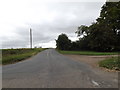
5
Heath Road, Ixworth
At the junction with the A1088 Thetford Road
Image: © Geographer
Taken: 19 Sep 2016
0.10 miles
6
Heath Road, Ixworth
At the junction with the A1088 Thetford Road
Image: © Geographer
Taken: 6 Sep 2016
0.10 miles
7
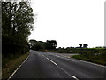
A1088 Thetford Road, Ixworth
At the junction with Heath Road
Image: © Geographer
Taken: 19 Sep 2016
0.10 miles
8
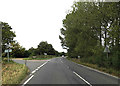
A1088 Thetford Road, Ixworth
At the junction with Heath Road
Image: © Geographer
Taken: 6 Sep 2016
0.10 miles
9
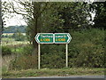
Roadsigns on the A1088 Thetford Road
At the junction with Heath Road
Image: © Geographer
Taken: 19 Sep 2016
0.10 miles
10
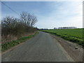
Minor Road heading East from Troston
Image: © Stuart Shepherd
Taken: 12 Apr 2015
0.10 miles