IMAGES TAKEN NEAR TO
Scott Road, BURY ST. EDMUNDS, IP31 2ER
Introduction
This page details the photographs taken nearby to Scott Road, IP31 2ER by members of the Geograph project.
The Geograph project started in 2005 with the aim of publishing, organising and preserving representative images for every square kilometre of Great Britain, Ireland and the Isle of Man.

There are currently over 7.5m images from over14,400 individuals and you can help contribute to the project by visiting https://www.geograph.org.uk
Image Map
Images are licensed for reuse under creativecommons.org/licenses/by-sa/2.0
Notes
- Clicking on the map will re-center to the selected point.
- The higher the marker number, the further away the image location is from the centre of the postcode.
Image Listing (92 Images Found)
Images are licensed for reuse under creativecommons.org/licenses/by-sa/2.0
Image
Details
Distance
2
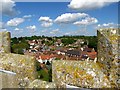
View north-east from St Mary's church tower
The church tower is not normally open to the public, and once you've climbed the steep spiral staircase the walls are so high you need a step-ladder to see over them. However the views are unique, no other building is as high or as centrally positioned in the village.
Image: © David Ayrton
Taken: 2 May 2011
0.13 miles
3
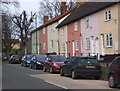
Colourful row of cottages, Ixworth High Street
Image: © Andrew Hill
Taken: 30 Mar 2008
0.14 miles
4
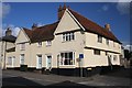
Jettied house in Ixworth High Street
This medieval house is situated on the corner of High Street and the cul-de-sac Crown Lane.
Image: © Bob Jones
Taken: 17 Apr 2008
0.15 miles
5
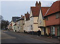
High Street, Ixworth, east side looking north
Image: © Andrew Hill
Taken: 30 Mar 2008
0.15 miles
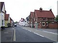
7
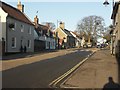
Ixworth High Street looking North
A lack of traffic on a Sunday afternoon shows how the High Street retains its old-fashioned feel.
Image: © David Ayrton
Taken: 6 Jan 2008
0.16 miles
9
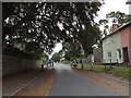
![Ixworth houses [43]](https://s3.geograph.org.uk/geophotos/06/70/87/6708779_8cd492b5_120x120.jpg)
Ixworth houses [43]
The Georgian House, number 78 High Street, is early 19th century in gault brick. Cast iron columns support the canopy over the entrance door. Listed, grade II, with details at: https://historicengland.org.uk/listing/the-list/list-entry/1031488
Ixworth is a village some 7 miles north east of Bury St Edmunds. Settled in Roman times and the site of a Roman fort. Later a civilian settlement was established and it became an important junction in the Roman road system of East Anglia. An Augustinian priory was founded in about 1170 and dissolved in 1537. Ixworth is the site of the earliest rural council housing built in England. Now most working residents commute to Bury St Edmunds.
Image: © Michael Dibb
Taken: 7 Sep 2020
0.16 miles