
IMAGES TAKEN NEAR TO
Grove Lane, BURY ST. EDMUNDS, IP31 2BB
Introduction
This page details the photographs taken nearby to Grove Lane, IP31 2BB by members of the Geograph project.
The Geograph project started in 2005 with the aim of publishing, organising and preserving representative images for every square kilometre of Great Britain, Ireland and the Isle of Man.

There are currently over 7.5m images from over14,400 individuals and you can help contribute to the project by visiting https://www.geograph.org.uk
Image Map
Images are licensed for reuse under creativecommons.org/licenses/by-sa/2.0
Notes
- Clicking on the map will re-center to the selected point.
- The higher the marker number, the further away the image location is from the centre of the postcode.
Image Listing (5 Images Found)
Images are licensed for reuse under creativecommons.org/licenses/by-sa/2.0
Image
Details
Distance

2

Track and Scrap Yard at Stanton Triangulation Pillar
Looking south-eastward.
Image: © Peter Wood
Taken: 24 Feb 2015
0.23 miles
3
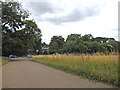
From the scrap yard you can just see...
.. a small part of the Shepherds Grove Park housing complex through the trees.
Image: © Adrian S Pye
Taken: 21 Jul 2019
0.24 miles
4

Scrap yard ..
...on the site of the old boiler room for Shepherds Grove airbase.
The chimney of the boiler room is visible behind and to the left of the telegraph pole
Image: © Adrian S Pye
Taken: 21 Jul 2019
0.24 miles
5

Stanton Post Mill
A working windmill supplying the local community with fine stoneground flours. (Makes lovely bread!)
Image: © Ian M
Taken: 29 Jul 2005
0.24 miles