
IMAGES TAKEN NEAR TO
Duke Street, BURY ST. EDMUNDS, IP31 2AB
Introduction
This page details the photographs taken nearby to Duke Street, IP31 2AB by members of the Geograph project.
The Geograph project started in 2005 with the aim of publishing, organising and preserving representative images for every square kilometre of Great Britain, Ireland and the Isle of Man.

There are currently over 7.5m images from over14,400 individuals and you can help contribute to the project by visiting https://www.geograph.org.uk
Image Map
Images are licensed for reuse under creativecommons.org/licenses/by-sa/2.0
Notes
- Clicking on the map will re-center to the selected point.
- The higher the marker number, the further away the image location is from the centre of the postcode.
Image Listing (37 Images Found)
Images are licensed for reuse under creativecommons.org/licenses/by-sa/2.0
Image
Details
Distance
2
Cottages in Stanton
Stanton village is situated about nine miles north-east of Bury St. Edmunds, on the A143 road to Diss. The former WW II airfield RAF Shepherds Grove, where American forces were based, is nearby. The village lies at the junction of the Peddars Way and dates back to Roman times. The present parish was formed from two earlier parishes, Stanton All Saints and Stanton St John, with John's church having been abandoned in the process.
Image: © Evelyn Simak
Taken: 5 May 2012
0.15 miles
3
B1111 Barningham Road, Stanton
At the junction with the A143 Bury Road
Image: © Geographer
Taken: 6 Aug 2016
0.16 miles
5
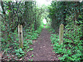
Footpath to the B1111, Stanton
The path links the B1111 road with the ruin of St John's church > http://www.geograph.org.uk/photo/2930656.
Image: © Evelyn Simak
Taken: 5 May 2012
0.16 miles
6
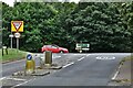
Stanton: Looking towards the A143 from Barmingham Road
Image: © Michael Garlick
Taken: 2 Sep 2021
0.17 miles
7
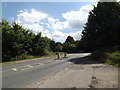
B1111 Barningham Road, Stanton
At the junction with the A143 Bury Road
Image: © Geographer
Taken: 6 Aug 2016
0.17 miles
8
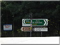
Roadsigns on the A143 Bury Road
At the junction with the B1111 Barningham Road
(Close up)
Image: © Geographer
Taken: 6 Aug 2016
0.17 miles
10
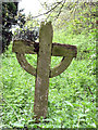
The ruin of St John's church in Stanton - churchyard
A broken gravemarker in the shape of a cross, standing in the nettles beside the footpath through the overgrown old graveyard adjoining the ruined St John's church > http://www.geograph.org.uk/photo/2931003.
Image: © Evelyn Simak
Taken: 5 May 2012
0.20 miles