
IMAGES TAKEN NEAR TO
New Cut East, IPSWICH, IP3 0ED
Introduction
This page details the photographs taken nearby to New Cut East, IP3 0ED by members of the Geograph project.
The Geograph project started in 2005 with the aim of publishing, organising and preserving representative images for every square kilometre of Great Britain, Ireland and the Isle of Man.

There are currently over 7.5m images from over14,400 individuals and you can help contribute to the project by visiting https://www.geograph.org.uk
Image Map
Images are licensed for reuse under creativecommons.org/licenses/by-sa/2.0
Notes
- Clicking on the map will re-center to the selected point.
- The higher the marker number, the further away the image location is from the centre of the postcode.
Image Listing (607 Images Found)
Images are licensed for reuse under creativecommons.org/licenses/by-sa/2.0
Image
Details
Distance
1
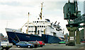
The ferry "Devoniun" at Ipswich
A passenger/vehicle ferry built in 1963/4, by Hall, Russell, Aberdeen as the “Hebrides” for David MacBrayne Ltd http://en.wikipedia.org/wiki/David_MacBrayne_Ltd. She later operated as the “Devoniun” for Torbay Seaways, between Torquay and the Channel Islands. The photograph shows her laid up at Ipswich, pending sale, after closure of those routes. The vessel was finally scrapped in India in 2003. A more detailed history can be found here http://en.wikipedia.org/wiki/MV_Hebrides_(1964). Subject position approximate – the area has since been redeveloped.
Image: © Albert Bridge
Taken: 14 Jun 1991
0.01 miles
2

William Kate Johnston in Ipswich Dock, 2003
William & Kate Johnston, which is listed on the United Kingdom's National Register of Historic Vessels, was launched in 1923. She was designed as a prototype lifeboat by James R. Barnett, Consulting Naval Architect to the Royal National Lifeboat Institution. She was built, with double diagonal teak hull, by J. Samuel White and Co. at Cowes.
At the time of her launch she was the largest lifeboat in the world. (Length: 60 ft; Bre. 15 ft; Displacement 44.5 tons; cruising speed 9 knots; cruising radius 200 nautical miles.)
See: http://www.william-kate-johnston.co.uk/
Behind is the old R & W Paul building, one of many mills which used to stand on the waterfront.
It stood derelict for a number of years, and now I understand it has been demolished as part of the Waterfront Regeneration Scheme.
See: http://www.bocmpauls.co.uk/bocm-pauls-about-us-our-history; http://ipswich-lettering.org/burtons.html
Image: © John Hardy
Taken: Unknown
0.02 miles
3
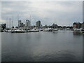
Ioswich, marina and tower blocks
The marina occupies the former Wet Dock.
Image: © Jonathan Thacker
Taken: 15 May 2022
0.02 miles
4
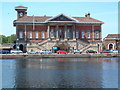
Ipswich Old Custom House
Taken from Ipswich Haven Marina in Ipswich Dock. The custom house in Key Street was built in 1844 to the design of J.M. Clark.
Image: © TREVOR NORRIS
Taken: 8 Jun 2005
0.02 miles
5
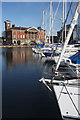
Ipswich Haven Marina and the Old Custom House
Viewed from the former Tovells Wharf, now home of the Ipswich Haven Marina Yacht Club, the Grade II Old Custom House commands a view across the Wet Dock, once the largest artificially enclosed area of water in the UK when completed in 1842.
Image: © Bob Jones
Taken: 4 Nov 2009
0.04 miles
6
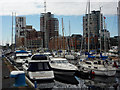
Ipswich marina
Looking across the marina to the western section of the waterfront development in the next square north.
Image: © Andrew Hill
Taken: 31 Aug 2009
0.04 miles
7
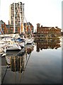
Ipswich Haven Marina
Pontoons lead northwards from the former Tovells Wharf, providing accommodation for over 250 yachts. On the far side of the Wet Dock is the Old Custom House, now the headquarters of ABP (Associated British Ports) Ipswich.
Image: © Bob Jones
Taken: 24 Feb 2011
0.04 miles
8
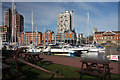
Ipswich Haven Marina
The waterfront at Ipswich seems to be constantly changing, with new construction taking place and old warehouses being converted. The building to the right of the photo is the Old Custom House, built in 1845, and is the headquarters of the port authority. The Wet Dock is no longer used commercially, and is home to hundreds of yachts. The former Tovells Wharf is now the base for Ipswich Haven Marina http://www.ports.co.uk/custinfo/other_op/abpmarinas.htm
Image: © Bob Jones
Taken: 4 Nov 2009
0.04 miles
9
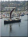
Ipswich Marina with restored Thames barge
Image: © Andrew Davis
Taken: 28 Sep 2008
0.04 miles
10
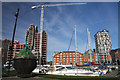
Ipswich Haven Marina
The old conical buoy and the quay at Ipswich haven Marina are within the square, but the buildings on the far side of the dock are in the adjacent square to the north. The tower crane is working on the building of apartments which will have the benefit of a very pleasant outlook across the dock.
Image: © Bob Jones
Taken: 4 Nov 2009
0.05 miles