
IMAGES TAKEN NEAR TO
Ship Launch Road, IPSWICH, IP3 0AS
Introduction
This page details the photographs taken nearby to Ship Launch Road, IP3 0AS by members of the Geograph project.
The Geograph project started in 2005 with the aim of publishing, organising and preserving representative images for every square kilometre of Great Britain, Ireland and the Isle of Man.

There are currently over 7.5m images from over14,400 individuals and you can help contribute to the project by visiting https://www.geograph.org.uk
Image Map
Images are licensed for reuse under creativecommons.org/licenses/by-sa/2.0
Notes
- Clicking on the map will re-center to the selected point.
- The higher the marker number, the further away the image location is from the centre of the postcode.
Image Listing (129 Images Found)
Images are licensed for reuse under creativecommons.org/licenses/by-sa/2.0
Image
Details
Distance
1
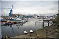
Ipswich Marina & Nicola Anne
Away from the bustle of the 2011 Maritime Festival. The fishing boat in the background; Nicola Anne is Colchester registered CK305, it has displacement of 42 tonnes and is fitted with a 370 horsepower engine, her home port is registered as Lowestoft.
Image: © Glyn Baker
Taken: 20 Aug 2011
0.05 miles
3
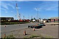
Site of St. Clement's Shipyard, Ipswich
Looking west from Cliff Road, just beyond Ship Launch Road. The shipyard here dates back to the construction of the Wet Dock in 1842, although there has probably been over 400 years of ship-building in the area.
Image: © Simon Mortimer
Taken: 10 Sep 2020
0.06 miles
4
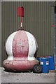
In need of a paint job
This navigation buoy stands outside a maintenance workshop at Ipswich Docks, awaiting a lick or two of paint.
Image: © Bob Jones
Taken: 3 Apr 2008
0.07 miles
5
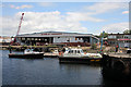
Harbourmaster's launch, Ipswich
The launch and, behind it, the 'Russell Paul' work boat, are berthed in the enclosed Wet Dock, adjacent to the entrance lock.
Image: © Bob Jones
Taken: 25 Jun 2008
0.07 miles
7
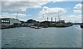
Jetty above Prince Philip Lock, Ipswich
The lock prevents the floating harbour drying out at low tide.
Image: © Christine Johnstone
Taken: 12 Jul 2017
0.08 miles
8

Sitting on the dock
No bay here, this is far from the sea in Ipswich docks. This is not actually the river, but a man-made branch off it.
Two seagulls chase each other round this ship. The new buildings on the east bank give a view across the water to the manufacturer of huge luxury power boats.
Image: © John Goldsmith
Taken: 3 Jun 2009
0.08 miles
9
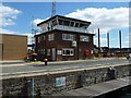
Control tower, Prince Philip Lock, Ipswich
The floating pontoon inside the lock is for smaller boats to tie up to.
Image: © Christine Johnstone
Taken: 12 Jul 2017
0.08 miles
10
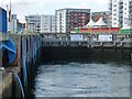
Prince Philip Lock, filling with water
The water is welling up from underwater sluices. The wet dock [floating harbour] is kept at the level of high tide, so when the tide has fallen, boats have to lock up into it.
Image: © Christine Johnstone
Taken: 12 Jul 2017
0.09 miles