
IMAGES TAKEN NEAR TO
Deadmans Lane, BURY ST. EDMUNDS, IP30 9TR
Introduction
This page details the photographs taken nearby to Deadmans Lane, IP30 9TR by members of the Geograph project.
The Geograph project started in 2005 with the aim of publishing, organising and preserving representative images for every square kilometre of Great Britain, Ireland and the Isle of Man.

There are currently over 7.5m images from over14,400 individuals and you can help contribute to the project by visiting https://www.geograph.org.uk
Image Map
Images are licensed for reuse under creativecommons.org/licenses/by-sa/2.0
Notes
- Clicking on the map will re-center to the selected point.
- The higher the marker number, the further away the image location is from the centre of the postcode.
Image Listing (3 Images Found)
Images are licensed for reuse under creativecommons.org/licenses/by-sa/2.0
Image
Details
Distance
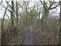
2
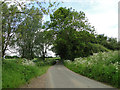
Un-named road and un-named woodland on the right
Image: © Adrian S Pye
Taken: 1 Jun 2015
0.17 miles
3
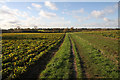
Footpath at Bishop Karney Green
This area just west of Woolpit is named after Bishop Arthur Baillie Lumsdaine Karney, b. 14 September 1874, d. 8 December 1963. He was the first Bishop of Johannesburg in the Anglican Church of Southern Africa and the Church of England. For a short period at the start of the 20th century he was, as a young man, Rector of Woolpit. His successor as Bishop of Johannesburg was Desmond Tutu.
A footpath runs across this land, acting as a short-cut between Broomhill Lane and Beyton Road.
Image: © Bob Jones
Taken: 26 Nov 2009
0.25 miles