
IMAGES TAKEN NEAR TO
Rougham, BURY ST. EDMUNDS, IP30 9NB
Introduction
This page details the photographs taken nearby to IP30 9NB by members of the Geograph project.
The Geograph project started in 2005 with the aim of publishing, organising and preserving representative images for every square kilometre of Great Britain, Ireland and the Isle of Man.

There are currently over 7.5m images from over14,400 individuals and you can help contribute to the project by visiting https://www.geograph.org.uk
Image Map
Images are licensed for reuse under creativecommons.org/licenses/by-sa/2.0
Notes
- Clicking on the map will re-center to the selected point.
- The higher the marker number, the further away the image location is from the centre of the postcode.
Image Listing (10 Images Found)
Images are licensed for reuse under creativecommons.org/licenses/by-sa/2.0
Image
Details
Distance
1
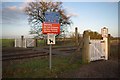
Footpath crossing near Thurston
This was clearly once a vehicular crossing (note the tall gatepost on the far side), but has now been downgraded to a footpath crossing, albeit one carrying National Cycle Network route 51.
Image: © Ben Harris
Taken: 14 Jan 2012
0.02 miles
2
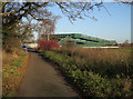
Bridge over railway
Carrying cycle route 51, hence the large ramps.
Image: © Hugh Venables
Taken: 22 Dec 2016
0.04 miles
3
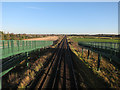
Railway to Thurston
With the sizeable ramps to carry cycle route 51 over the railway.
Image: © Hugh Venables
Taken: 22 Dec 2016
0.05 miles
4

Railway at Thurston
Container train passing the new footbridge outside Thurston.
Image: © Wayland Smith
Taken: 23 Feb 2019
0.12 miles

7
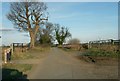
Country lane, close to Thurston
This lane is now used as part of cycle route 51. Further along the lane it becomes Heath Road when it reaches Thurston.
Image: © Robert Edwards
Taken: 8 Feb 2011
0.18 miles
8
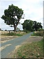
Cycle Route 51
National cycle route number 51 after being a cycle way only for many miles now joins a public road near to Blackthorpe, Suffolk.
Image: © Keith Evans
Taken: 31 Aug 2009
0.20 miles
10
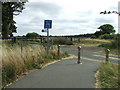
End Of Route
End of the national cycle route number 51 near to Blackthorpe, Suffolk.
Image: © Keith Evans
Taken: 31 Aug 2009
0.24 miles