IMAGES TAKEN NEAR TO
Shrubbery Close, BURY ST. EDMUNDS, IP30 9GP

Introduction

This page details the photographs taken nearby to Shrubbery Close, IP30 9GP by members of the Geograph project.

The Geograph project started in 2005 with the aim of publishing, organising and preserving representative images for every square kilometre of Great Britain, Ireland and the Isle of Man.

There are currently over 7.5m images from over14,400 individuals and you can help contribute to the project by visiting https://www.geograph.org.uk

Image Map


Images are licensed for reuse under creativecommons.org/licenses/by-sa/2.0
Notes
  • Clicking on the map will re-center to the selected point.
  • The higher the marker number, the further away the image location is from the centre of the postcode.

Image Listing (13 Images Found)

Images are licensed for reuse under creativecommons.org/licenses/by-sa/2.0
Image
Details
Distance
1
Manor Lane towards Hessett
The lane crosses open fields after rising slightly from Manor Bridge.
Image: © Andrew Hill Taken: 21 Aug 2009
0.21 miles
2
Village Green, Hessett
Image: © Stuart Shepherd Taken: 10 Jul 2010
0.21 miles
3
Village green, Hessett
A pleasant green with a distant view of the church amongst the trees.
Image: © Andrew Hill Taken: 21 Aug 2009
0.21 miles
4
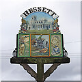
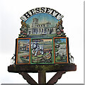
Hessett's village sign
Image: © Robert Edwards Taken: 30 Mar 2009
0.22 miles
5
Hessett: The sign on the village green
Image: © Michael Garlick Taken: 1 Nov 2015
0.23 miles
6
Hessett village sign
Set on the edge of the village green near the lane junction.
Image: © Andrew Hill Taken: 21 Aug 2009
0.23 miles
7
Hessett village sign (south)
Hessett sign is double sided with different images. The imposing church of St. Ethelbert features on both sides as the most outstanding feature. On the side facing north, of the three panels, the first features The Five Bells public house, the second a farming scene with a grey shire horse ploughing while a cock pheasant looks on. The third panel shows a ram and ewe indicating a strong connection with the mediaeval wool trade and explaining the size of the church. On the south side a few of mallards are in the drainage ditch with runs beside road near the pub, the centre panel shows a tractor pulling a seed drill. I believe the figure in the third panel is John Bacon benefactor to the church and the parish in general. https://www.geograph.org.uk/photo/6663363
Image: © Adrian S Pye Taken: 3 Nov 2020
0.23 miles
8
Hessett village sign (north)
Hessett sign is double sided with different images. The imposing church of St. Ethelbert features on both sides as the most outstanding feature. On the side facing north, of the three panels, the first features The Five Bells public house, the second a farming scene with a grey shire horse ploughing while a cock pheasant looks on. The third panel shows a ram and ewe indicating a strong connection with the mediaeval wool trade and explaining the size of the church. On the south side a few of mallards are in the drainage ditch with runs beside road near the pub, the centre panel shows a tractor pulling a seed drill. I believe the figure in the third panel is John Bacon benefactor to the church and the parish in general. https://www.geograph.org.uk/photo/6663363
Image: © Adrian S Pye Taken: 3 Nov 2020
0.23 miles
9
Hessett village sign
Hessett sign is double sided with different images. The imposing church of St. Ethelbert features on both sides as the most outstanding feature. On the side facing north, of the three panels, the first features The Five Bells public house, the second a farming scene with a grey shire horse ploughing while a cock pheasant looks on. The third panel shows a ram and ewe indicating a strong connection with the mediaeval wool trade and explaining the size of the church. On the south side a few of mallards are in the drainage ditch with runs beside road near the pub, the centre panel shows a tractor pulling a seed drill. I believe the figure in the third panel is John Bacon benefactor to the church and the parish in general. https://www.geograph.org.uk/photo/6663361 https://www.geograph.org.uk/photo/6663362
Image: © Adrian S Pye Taken: 3 Nov 2020
0.23 miles
10
Lane junction in Hessett
The start of Heath Road leaving the main lane through the village.
Image: © Andrew Hill Taken: 21 Aug 2009
0.24 miles