
IMAGES TAKEN NEAR TO
Elmswell, BURY ST. EDMUNDS, IP30 9ER
Introduction
This page details the photographs taken nearby to IP30 9ER by members of the Geograph project.
The Geograph project started in 2005 with the aim of publishing, organising and preserving representative images for every square kilometre of Great Britain, Ireland and the Isle of Man.

There are currently over 7.5m images from over14,400 individuals and you can help contribute to the project by visiting https://www.geograph.org.uk
Image Map
Images are licensed for reuse under creativecommons.org/licenses/by-sa/2.0
Notes
- Clicking on the map will re-center to the selected point.
- The higher the marker number, the further away the image location is from the centre of the postcode.
Image Listing (66 Images Found)
Images are licensed for reuse under creativecommons.org/licenses/by-sa/2.0
Image
Details
Distance
1

Bunkers Hill
Rural Suffolk in the oil seed rape season.
Image: © roger geach
Taken: 17 May 2012
0.00 miles


4

Cut-through from Elmswell to the A1088 at Bunker's Hill
Originally designed as a dead end, not allowing traffic to join the fast A1088 local traffic has created its own through road.
Image: © Adrian S Pye
Taken: 21 Jul 2019
0.05 miles
5

Track to Bunkers Hill Farm from Elmswell
The grey cloud was just clearing and in a pale way colour was beginning to appear on this cold morning with lying snow.
Image: © Andrew Hill
Taken: 19 Dec 2009
0.10 miles
6

Stream west of Elmswell
A man with a dog walks by the stream on a bleak winter morning. Not too long after the sun did come through but it remained bitterly cold.
Image: © Andrew Hill
Taken: 19 Dec 2009
0.10 miles

8
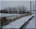
Snowscene by the Bunkers Hill Farm road
Fields and laneside near the A1088 junction.
Image: © Andrew Hill
Taken: 19 Dec 2009
0.14 miles
9

Stream at Elmswell
This stream divides the fields; in the distance is the railway line on an embankment and behind it, Elmswell Hall.
Image: © Bob Jones
Taken: 20 Sep 2006
0.16 miles
10
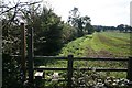
Footpath to Earthfield Lane
This path links the A1088 and the A14, at Elmswell.
Image: © Bob Jones
Taken: 23 Sep 2006
0.16 miles