IMAGES TAKEN NEAR TO
Stowmarket Road, BURY ST. EDMUNDS, IP30 0RS

Introduction

This page details the photographs taken nearby to Stowmarket Road, IP30 0RS by members of the Geograph project.

The Geograph project started in 2005 with the aim of publishing, organising and preserving representative images for every square kilometre of Great Britain, Ireland and the Isle of Man.

There are currently over 7.5m images from over14,400 individuals and you can help contribute to the project by visiting https://www.geograph.org.uk

Image Map


Images are licensed for reuse under creativecommons.org/licenses/by-sa/2.0
Notes
  • Clicking on the map will re-center to the selected point.
  • The higher the marker number, the further away the image location is from the centre of the postcode.

Image Listing (82 Images Found)

Images are licensed for reuse under creativecommons.org/licenses/by-sa/2.0
  • ...
Image
Details
Distance
1
Entering Rattlesden on Lower Road
At the junction with High Street & Stowmarket Road
Image: © Geographer Taken: 25 May 2016
0.02 miles
2
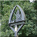
Rattlesden Village Name sign on Lower Road
At the junction with High Street & Stowmarket Road
Image: © Geographer Taken: 25 May 2016
0.03 miles
3
Rattlesden: Extended bungalow
Image: © Michael Garlick Taken: 5 Nov 2020
0.03 miles
4
Rattlesden War Memorial
The memorial records the names of 26 men from Rattlesden who went to war and never returned. Below the main tablet are the names of three men lost in WW2.
Image: © Adrian S Pye Taken: 12 Jan 2020
0.03 miles
5
Rattlesden village sign (detail)
You'd be forgiven for being rather confused by the presence of an anchor and whale bones on the sign of this inland village between Bury St Edmunds and Stowmarket. Rattlesden - based on the River Rat - has a long connection with water-based navigation and a door handle on the St Nicholas Church was allegedly made out of an anchor found nearby on the riverbed. The whalebones were arranged in arch over the Rat in the 19th century by a local homeowner although the bones there today are replicas of the original. https://www.geograph.org.uk/photo/6775419
Image: © Adrian S Pye Taken: 25 Aug 2008
0.03 miles
6
Rattlesden Village sign
Off Lower Road at the junction with High Street & Stowmarket Road (Close up)
Image: © Geographer Taken: 25 May 2016
0.04 miles
7
Rattlesden Village sign
Off Lower Road at the junction with High Street & Stowmarket Road
Image: © Geographer Taken: 25 May 2016
0.04 miles
8
Rattlesden War Memorial
The memorial records the names of 26 men from Rattlesden who went to war and never returned. Below the main tablet are the names of three men lost in WW2. https://www.geograph.org.uk/photo/6365832 https://www.geograph.org.uk/photo/6365828
Image: © Adrian S Pye Taken: 12 Jan 2020
0.04 miles
9
Rattlesden War Memorial
The memorial records the names of 26 men from Rattlesden who went to war and never returned. Below the main tablet are the names of three men lost in WW2. https://www.geograph.org.uk/photo/6365828
Image: © Adrian S Pye Taken: 12 Jan 2020
0.04 miles
10
Lower Road sign
On Lower Road at the junction with High Street & Stowmarket Road
Image: © Geographer Taken: 25 May 2016
0.04 miles
  • ...