IMAGES TAKEN NEAR TO
Felsham, BURY ST. EDMUNDS, IP30 0PT
Introduction
This page details the photographs taken nearby to IP30 0PT by members of the Geograph project.
The Geograph project started in 2005 with the aim of publishing, organising and preserving representative images for every square kilometre of Great Britain, Ireland and the Isle of Man.

There are currently over 7.5m images from over14,400 individuals and you can help contribute to the project by visiting https://www.geograph.org.uk
Image Map
Images are licensed for reuse under creativecommons.org/licenses/by-sa/2.0
Notes
- Clicking on the map will re-center to the selected point.
- The higher the marker number, the further away the image location is from the centre of the postcode.
Image Listing (20 Images Found)
Images are licensed for reuse under creativecommons.org/licenses/by-sa/2.0
Image
Details
Distance
1
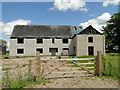
Half finished house awaiting planning consent
Image: © Adrian S Pye
Taken: 1 Jun 2015
0.01 miles
2
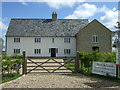
New house for sale near Castle Farm
See Image] for when under construction.
Image: © JThomas
Taken: 25 Apr 2017
0.02 miles
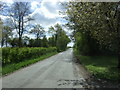
3

Road to Lower Green
At the junction with the By Road near Castle Farm
Image: © Geographer
Taken: 14 Jun 2014
0.03 miles
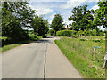
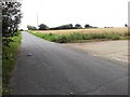
4
Minor road near Castle Farm
Looking south east.
Image: © JThomas
Taken: 25 Apr 2017
0.03 miles
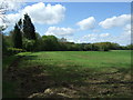
7
A concrete track off a country road
The track runs towards Felsham Wood
Image: © Helen Steed
Taken: 30 Jul 2012
0.08 miles
8
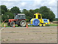
Sky Launch
The blue and yellow vehicle is a Sky Launch 2 http://www.skylaunchuk.com/skylaunch2.php a high powered winch to launch gliders as seen here at Rattlesden Gliding Club near to Hightown Green, Suffolk.
Image: © Keith Evans
Taken: 28 Aug 2011
0.12 miles
9
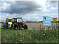
Entrance To Rattlesden Gliding Club
The gliding club launch vehicle http://www.geograph.org.uk/photo/2596510 at the former WWII airfield RAF Rattlesden http://en.wikipedia.org/wiki/RAF_Rattlesden with a large spelling mistake on the club sign of the letter T x 3 in the name Rattlesden.
Image: © Keith Evans
Taken: 28 Aug 2011
0.12 miles
10
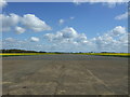
Runway, former Royal Air Force Station Rattlesden
Ex WWII airbase - landing strip still used by a gliding club.
Image: © JThomas
Taken: 25 Apr 2017
0.13 miles