
IMAGES TAKEN NEAR TO
Ixer Lane, BURY ST. EDMUNDS, IP30 0LR
Introduction
This page details the photographs taken nearby to Ixer Lane, IP30 0LR by members of the Geograph project.
The Geograph project started in 2005 with the aim of publishing, organising and preserving representative images for every square kilometre of Great Britain, Ireland and the Isle of Man.

There are currently over 7.5m images from over14,400 individuals and you can help contribute to the project by visiting https://www.geograph.org.uk
Image Map
Images are licensed for reuse under creativecommons.org/licenses/by-sa/2.0
Notes
- Clicking on the map will re-center to the selected point.
- The higher the marker number, the further away the image location is from the centre of the postcode.
Image Listing (51 Images Found)
Images are licensed for reuse under creativecommons.org/licenses/by-sa/2.0
Image
Details
Distance
1
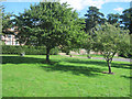
Bradfield Combust village green
Bounded by A134 and Ixer Lane
Image: © John Firth
Taken: 17 Sep 2010
0.06 miles
2
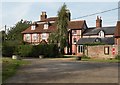
A view of Bradfield House from Ixer Lane
Image: © Robert Edwards
Taken: 22 Sep 2010
0.07 miles
3
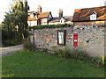
Ixer Lane Victorian Postbox
On Ixer Lane
Postbox No.IP30 2020
Image: © Geographer
Taken: 3 Oct 2014
0.07 miles
4
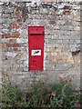
Ixer Lane Victorian Postbox
On Ixer Lane
Postbox No.IP30 2020
(Close up)
Image: © Geographer
Taken: 3 Oct 2014
0.07 miles
5
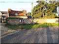
Ixer Lane Victorian Postbox
On Ixer Lane
Postbox No.IP30 2020
Image: © Geographer
Taken: 3 Oct 2014
0.07 miles
6
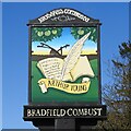
Bradfield Combust village sign
This side of the sign celebrates Arthur Young (1741–1820), who lived in Bradfield Hall, an agriculturalist and great socio-political writer and campaigner for the rights of agricultural workers. The other side of the slide shows the village in flames. There seems to some confusion as to why Bradfield Combust is so named, but the village never had a disastrous fire. The name Bradfield Combust is traditionally said to have derived from an incident in the autumn of 1327, when an angry mob burned down Bradfield Hall, but it was called Bradfield Combust before that event ever took place. https://www.geograph.org.uk/photo/4504686
Image: © Adrian S Pye
Taken: 26 Feb 2021
0.08 miles
7
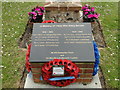
The War Memorial at Bradfield Combust
Placed below the village sign the black slate bears the names of nine men. WW1 Casualties: J.E. CULLING, H.W. GAULT, J. MAKIN, A.J. SMITH and H. SPARKE. WW2 Casualties: W. MIDDLEDITCH, D.W. SAVOY, G.H. SAVOY and B.F. TALBOTT.
Image: © Adrian S Pye
Taken: 1 Jun 2015
0.08 miles
8
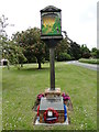
Bradfield Combust village sign and War Memorial
The Memorial which is just independent of the village sign has the names of five men lost in WW1 and of four lost in WW2. Another Memorial can be seen in St. George's church.
Image: © Adrian S Pye
Taken: 1 Jun 2015
0.08 miles
9
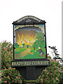
Bradfield Combust village sign (detail)
Image: © Adrian S Pye
Taken: 1 Jun 2015
0.08 miles
10

Bradfield Combust Village sign
Off the A134 The Street
(close up)
Image: © Geographer
Taken: 3 Oct 2014
0.08 miles