IMAGES TAKEN NEAR TO
Winchester Way, IPSWICH, IP2 9YL
Introduction
This page details the photographs taken nearby to Winchester Way, IP2 9YL by members of the Geograph project.
The Geograph project started in 2005 with the aim of publishing, organising and preserving representative images for every square kilometre of Great Britain, Ireland and the Isle of Man.

There are currently over 7.5m images from over14,400 individuals and you can help contribute to the project by visiting https://www.geograph.org.uk
Image Map
Images are licensed for reuse under creativecommons.org/licenses/by-sa/2.0
Notes
- Clicking on the map will re-center to the selected point.
- The higher the marker number, the further away the image location is from the centre of the postcode.
Image Listing (37 Images Found)
Images are licensed for reuse under creativecommons.org/licenses/by-sa/2.0
Image
Details
Distance
1
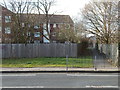
Path near Bourne Park
There was once a footbridge here (Google Maps still shows it) see http://www.geograph.org.uk/photo/1112182 for a photo of it.
Image: © Hamish Griffin
Taken: 21 Feb 2014
0.02 miles
2
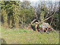
Trolley from Asda, Stoke Park
Looks like it has come from Asda, Stoke Park.
Image: © Hamish Griffin
Taken: 21 Feb 2014
0.03 miles
3
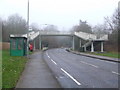
No longer a footbridge
There was once a footbridge here see http://www.geograph.org.uk/photo/1112182 but it was taken down. Google Maps, A-Z Suffolk 2013 edition and the submit form detailed map still show it.
Image: © Hamish Griffin
Taken: 21 Feb 2014
0.03 miles
4
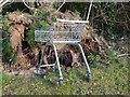
Trolley from Asda, Stoke Park (close up)
See http://www.geograph.org.uk/photo/3856153 for a general view.
Image: © Hamish Griffin
Taken: 21 Feb 2014
0.03 miles
5
Footbridge
Footbridge over Stoke Park Drive Ipswich Suffolk.
Image: © Keith Evans
Taken: 8 Jan 2009
0.04 miles
6
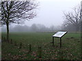
Belstead Brook Park
Belstead Brook park information board Ipswich Suffolk.
Image: © Keith Evans
Taken: 8 Jan 2009
0.07 miles
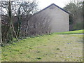
7
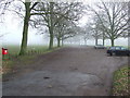
Belstead Brook Park Car Park
Belstead Brook park car park Ipswich Suffolk.
Image: © Keith Evans
Taken: 8 Jan 2009
0.10 miles
8
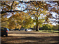
Car park, Bourne Park, Ipswich
The nearer trees are chestnuts.
Image: © Robin Webster
Taken: 19 Nov 2017
0.10 miles
9
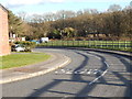
Whitland Close
Whitland Close is a dead end road of Stoke Park Drive http://www.geograph.org.uk/photo/3859247.
Image: © Hamish Griffin
Taken: 21 Feb 2014
0.12 miles
10
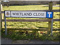
Whitland Close dead end sign
Whitland Close dead end sign. Whitland Close starts/ends at Stoke Park Drive.
Image: © Hamish Griffin
Taken: 21 Feb 2014
0.12 miles