1
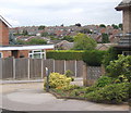
Flats in Hale Close, Chantry, south-west Ipswich
Oak House is one of three similar blocks, the others being Beech House and Ash House. Postal area is IP2.
Image: © Andrew Hill
Taken: 18 Jul 2008
0.03 miles
2
Radcliffe Drive continues rising beyond Clifton Way junction
A pleasant residential street in south-west Ipswich, IP2.
Image: © Andrew Hill
Taken: 18 Jul 2008
0.05 miles
3
Chantry area of south-west Ipswich
Large residential development, mainly modern, in IP2 postal area.
Image: © Andrew Hill
Taken: 18 Jul 2008
0.10 miles
4
Looking down Bridgwater Road, Chantry, Ipswich
View to the countryside beyond.
Image: © Andrew Hill
Taken: 18 Jul 2008
0.10 miles
5
Holcombe Crescent, Chantry, south-west Ipswich
Residential street viewed from the junction with Bridgwater Road, IP2.
Image: © Andrew Hill
Taken: 18 Jul 2008
0.13 miles
6
Holcombe Crescent, Chantry, south-west Ipswich
Looking to Bridgwater Road, IP2.
Image: © Andrew Hill
Taken: 18 Jul 2008
0.15 miles
7
Hawthorn Drive, Chantry, at junction with Greenfinch Avenue
Large residential development of south-west Ipswich, IP2.
Image: © Andrew Hill
Taken: 18 Jul 2008
0.17 miles
8
Looking up Radcliffe Drive
A residential area of south-west Ipswich, IP2. This part of Ipswich is actually quite hilly (at least by Suffolk standards).
Image: © Andrew Hill
Taken: 18 Jul 2008
0.19 miles
9
Co-op Foodstore, Hawthorn Road, south-west Ipswich
Workmen were busy as I passed by. The store serves part of a large residential area, IP2 and IP8 postcode areas.
Image: © Andrew Hill
Taken: 18 Jul 2008
0.20 miles
10
Belstead Arms Public House
On Radcliffe Drive at the junction with Ellenbrook Road
https://www.facebook.com/pages/The-Belstead-Arms/148693511834645
Image: © Geographer
Taken: 21 Aug 2014
0.21 miles


