IMAGES TAKEN NEAR TO
College Close, BURY ST. EDMUNDS, IP29 5SL
Introduction
This page details the photographs taken nearby to College Close, IP29 5SL by members of the Geograph project.
The Geograph project started in 2005 with the aim of publishing, organising and preserving representative images for every square kilometre of Great Britain, Ireland and the Isle of Man.

There are currently over 7.5m images from over14,400 individuals and you can help contribute to the project by visiting https://www.geograph.org.uk
Image Map
Images are licensed for reuse under creativecommons.org/licenses/by-sa/2.0
Notes
- Clicking on the map will re-center to the selected point.
- The higher the marker number, the further away the image location is from the centre of the postcode.
Image Listing (66 Images Found)
Images are licensed for reuse under creativecommons.org/licenses/by-sa/2.0
Image
Details
Distance
1
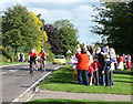
Cycle Tour of Britain 2010
A handful of club cyclists test the route ahead of the actual race, here passing through the village of Horringer. The primary school children and staff cheer and wave enthusiastically at anything that moves.
I'd rather cheer that nice yellow MG ZS180.
Image: © John Goldsmith
Taken: 17 Sep 2010
0.05 miles
4
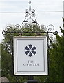
Sign for the Six Bells, Horringer
See Image] for context.
Image: © JThomas
Taken: 31 Aug 2019
0.06 miles
5
![Horringer houses [4]](https://s2.geograph.org.uk/geophotos/06/76/08/6760806_8e6a062f_120x120.jpg)
Horringer houses [4]
Originally a pair of cottages, now one, The Thatched Cottage in the Street is probably 18th century, timber framed and plastered.
The small village of Horringer, earlier known as Horningsheath lies astride the A143 road some two miles south west of Bury St Edmunds. The village includes the main entrance to Ickworth Park. There was once three blacksmiths’ forges in the village.
Image: © Michael Dibb
Taken: 15 Sep 2020
0.06 miles
6
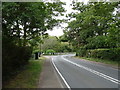
Bend on The Street (A143), Horringer
Towards Bury St Edmunds.
Image: © JThomas
Taken: 31 Aug 2019
0.07 miles
7
![Horringer houses [9]](https://s0.geograph.org.uk/geophotos/06/76/08/6760836_b161974c_120x120.jpg)
Horringer houses [9]
Pheasant Cottage, The Street, is 17th century, timber framed and plastered with a thatched roof. Alterations were made in circa 1840. Listed, grade II, with details at: https://historicengland.org.uk/listing/the-list/list-entry/1298944
The small village of Horringer, earlier known as Horningsheath lies astride the A143 road some two miles south west of Bury St Edmunds. The village includes the main entrance to Ickworth Park. There was once three blacksmiths’ forges in the village.
Image: © Michael Dibb
Taken: 15 Sep 2020
0.08 miles
8
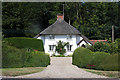
Ashdown Cottage, Horringer
This thatched 'teapot' cottage is situated on the west side of the A143, known as The Street, opposite Meadow Drive.
Image: © Bob Jones
Taken: 10 Jul 2009
0.09 miles
9
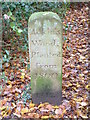
Adkins Wood
Stone pillar at Adkins wood Ickworth park Suffolk.
Image: © Keith Evans
Taken: 2 Dec 2006
0.09 miles