
IMAGES TAKEN NEAR TO
Little Saxham, BURY ST. EDMUNDS, IP29 5LB
Introduction
This page details the photographs taken nearby to IP29 5LB by members of the Geograph project.
The Geograph project started in 2005 with the aim of publishing, organising and preserving representative images for every square kilometre of Great Britain, Ireland and the Isle of Man.

There are currently over 7.5m images from over14,400 individuals and you can help contribute to the project by visiting https://www.geograph.org.uk
Image Map
Images are licensed for reuse under creativecommons.org/licenses/by-sa/2.0
Notes
- Clicking on the map will re-center to the selected point.
- The higher the marker number, the further away the image location is from the centre of the postcode.
Image Listing (7 Images Found)
Images are licensed for reuse under creativecommons.org/licenses/by-sa/2.0
Image
Details
Distance
1
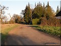
A bridleway and track to Old Warren Wood
Image: © Robert Edwards
Taken: 19 Mar 2011
0.03 miles
2

Oilseed rape and cow parsley
Viewed from the minor road that links Little Saxham and Risby, the field near Honey Hill Farm is filled with flowering oilseed rape, whilst the roadside verge provides a foreground of cow parsley.
Image: © Bob Jones
Taken: 27 Apr 2014
0.12 miles
3
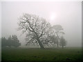
Angled oak in the mist
The fields in this area are fenced paddocks for the equine facility at Honeyhill Farm. This old oak is leaning perilously, but otherwise appears to be in good condition.
Image: © Bob Jones
Taken: 29 Jan 2012
0.16 miles
4
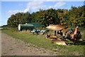
Farm machinery at Honey Hill Farm
These assorted items lie just north of the farm buildings.
Image: © Bob Jones
Taken: 4 Oct 2007
0.21 miles
5
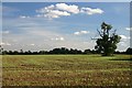
Farmland at Little Saxham
This tree stands alone in a field, opposite Honey Hill Farm. Winter wheat is starting to show in the field.
Image: © Bob Jones
Taken: 4 Oct 2007
0.23 miles
6
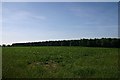
Windsor Wood, Little Saxham
Planted in 1828/29 with acorns from Windsor Home Park.
Image: © Bob Jones
Taken: 22 Jun 2005
0.24 miles
7
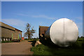
Farm buildings at Honeyhill Farm
The large tank in the foreground is used to store fertiliser.
Image: © Bob Jones
Taken: 25 Apr 2009
0.24 miles