IMAGES TAKEN NEAR TO
The Green, BURY ST. EDMUNDS, IP29 5DT
Introduction
This page details the photographs taken nearby to The Green, IP29 5DT by members of the Geograph project.
The Geograph project started in 2005 with the aim of publishing, organising and preserving representative images for every square kilometre of Great Britain, Ireland and the Isle of Man.

There are currently over 7.5m images from over14,400 individuals and you can help contribute to the project by visiting https://www.geograph.org.uk
Image Map
Images are licensed for reuse under creativecommons.org/licenses/by-sa/2.0
Notes
- Clicking on the map will re-center to the selected point.
- The higher the marker number, the further away the image location is from the centre of the postcode.
Image Listing (22 Images Found)
Images are licensed for reuse under creativecommons.org/licenses/by-sa/2.0
Image
Details
Distance
1
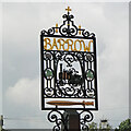
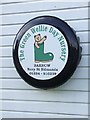
Barrow village sign
The locomotive featured on the sign (named 'Chough') is part of a 15-inch narrow-gauge railway loop 350 yards in length which once ran at a farm in the village. The sword relates to the distant Saxon past.
Image: © Adrian S Pye
Taken: 5 Apr 2016
0.05 miles
2
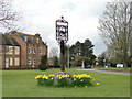
Barrow village sign
The locomotive featured on the sign (named 'Chough') is part of a 15-inch narrow-gauge railway loop 350 yards in length which once ran at a farm in the village.
Image: © Adrian S Pye
Taken: 5 Apr 2016
0.05 miles
3
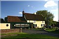
Weeping Willow PH, Barrow
One of two public houses in the village of Barrow, and the possible venue for the next meeting of EARWIG (Eastern Area Reunion With Interesting Geographers) next February.
Image: © Bob Jones
Taken: 24 Sep 2007
0.06 miles
4
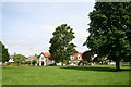
Barrow village green
The triangular village green in Barrow, four miles west of Bury St Edmunds.
Image: © Bob Jones
Taken: 4 Aug 2005
0.06 miles
6
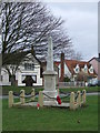
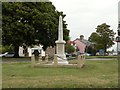
War Memorial
War Memorial Barrow, Suffolk.
Image: © Keith Evans
Taken: 27 Jan 2011
0.07 miles
8
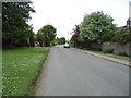
Barrow Hill, Barrow
Looking south east on National Cycle Route 51.
Image: © JThomas
Taken: 21 May 2016
0.08 miles
9
4X4 wheel cover
Wheel cover advertising the Nursery that is attached to Barrow Suffolk for full view see http://www.geograph.org.uk/photo/963980
Image: © Keith Evans
Taken: 14 Sep 2008
0.08 miles
10
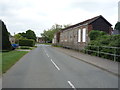
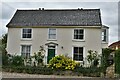
Stone farm building on Denham, Lane, Barrow
National Cycle Route 51.
Image: © JThomas
Taken: 21 May 2016
0.08 miles