
IMAGES TAKEN NEAR TO
Bury Road, BURY ST. EDMUNDS, IP29 4TA
Introduction
This page details the photographs taken nearby to Bury Road, IP29 4TA by members of the Geograph project.
The Geograph project started in 2005 with the aim of publishing, organising and preserving representative images for every square kilometre of Great Britain, Ireland and the Isle of Man.

There are currently over 7.5m images from over14,400 individuals and you can help contribute to the project by visiting https://www.geograph.org.uk
Image Map
Images are licensed for reuse under creativecommons.org/licenses/by-sa/2.0
Notes
- Clicking on the map will re-center to the selected point.
- The higher the marker number, the further away the image location is from the centre of the postcode.
Image Listing (30 Images Found)
Images are licensed for reuse under creativecommons.org/licenses/by-sa/2.0
Image
Details
Distance
1
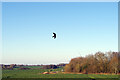
Bird scarer at Whepstead
The scarer is attached to a flexible pole that makes it swoop and dive in the wind emulating a real bird of prey. It is not particularly realistic to human eyes but no doubt petrifies small birds.
Image: © Stephen McKay
Taken: 19 Mar 2022
0.10 miles
2
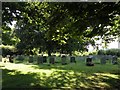
The graveyard at Whepstead
This graveyard stands by the parish church but on the opposite side of the road.
Image: © Robert Edwards
Taken: 1 Jul 2009
0.11 miles
3
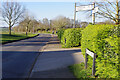
Bury Road, Whepstead
The B1066 heads north out of Whepstead towards Bury St Edmunds. Church Hill is signposted to the left, leading eventually to Chedburgh 2½ miles distant; the church itself has no distance given but is in fact only about 100 metres away.
Image: © Stephen McKay
Taken: 19 Mar 2022
0.11 miles
4
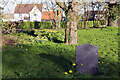
Whepstead Churchyard
Additional space for the churchyard was found on the opposite side of the road from the church itself in 1930. This view shows part of the area suitably brightened up with clumps of daffodils.
Image: © Stephen McKay
Taken: 19 Mar 2022
0.12 miles
5
Whepstead village sign
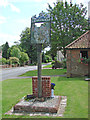
Above the name is Saint Petronilla, holding a cross and keys, as the daughter of St Peter. In the main picture the church of St Petronilla (the only dedication to her in England) can be seen across the field in which a serf is harvesting the corn. Mid-foreground a nun is pouring water to wash the hands of an old woman (the meaning of which is not known despite enquiries). A basket maker is busy making baskets and other objects from osier growing beside the River Lark. https://www.geograph.org.uk/photo/6787273 https://www.geograph.org.uk/photo/3967838
Image: © Adrian S Pye
Taken: 28 Jul 2007
0.13 miles
6
Whepstead Village Sign
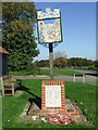
Village sign and war memorial at Whepstead, Suffolk for close up of the sign see http://www.geograph.org.uk/photo/2106149
Image: © Keith Evans
Taken: 10 Oct 2010
0.13 miles
7
Whepstead village sign
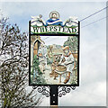
Above the name is Saint Petronilla, holding a cross and keys, as the daughter of St Peter. In the main picture the church of St Petronilla (the only dedication to her in England) can be seen across the field in which a serf is harvesting the corn. Mid-foreground a nun is pouring water to wash the hands of an old woman (the meaning of which is not known despite enquiries). A basket maker is busy making baskets and other objects from osier growing beside the River Lark. https://www.geograph.org.uk/photo/4295597
Whepstead War Memorial https://www.geograph.org.uk/photo/4895822
Image: © Adrian S Pye
Taken: 5 Apr 2016
0.13 miles
8
Whepstead Village Sign
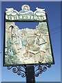
Close up of the village sign at Whepstead, Suffolk for overall view see http://www.geograph.org.uk/photo/2106144
Image: © Keith Evans
Taken: 10 Oct 2010
0.13 miles
9
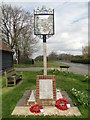
Whepstead War Memorial and village sign
The memorial bears thirteen names from WW1 and three from WW2.
In the church is a book containing the full service details of all the men.
Image: © Adrian S Pye
Taken: 5 Apr 2016
0.14 miles
10
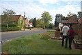
Whepstead
Showing the village sign with the war memorial below it. Across the road, the ivy-covered building is the former Board School.
Image: © Trevor Harris
Taken: 15 May 2010
0.14 miles