IMAGES TAKEN NEAR TO
Somerton Road, BURY ST. EDMUNDS, IP29 4NA
Introduction
This page details the photographs taken nearby to Somerton Road, IP29 4NA by members of the Geograph project.
The Geograph project started in 2005 with the aim of publishing, organising and preserving representative images for every square kilometre of Great Britain, Ireland and the Isle of Man.

There are currently over 7.5m images from over14,400 individuals and you can help contribute to the project by visiting https://www.geograph.org.uk
Image Map
Images are licensed for reuse under creativecommons.org/licenses/by-sa/2.0
Notes
- Clicking on the map will re-center to the selected point.
- The higher the marker number, the further away the image location is from the centre of the postcode.
Image Listing (11 Images Found)
Images are licensed for reuse under creativecommons.org/licenses/by-sa/2.0
Image
Details
Distance
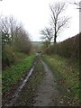
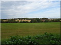
1
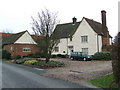
Millhill farmhouse
Millhill farmhouse near to Hartest, Suffolk.
Image: © Keith Evans
Taken: 18 Dec 2008
0.02 miles
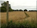
7
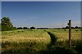
Footpath to Boxted
Looking south from the minor road at Mile End.
Image: © Bob Jones
Taken: 3 Jul 2006
0.11 miles
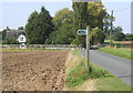
8
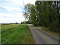
Smithbrook Lane
Looking north along Smithbrook Lane near to Hartest Suffolk.
Image: © Keith Evans
Taken: 18 Dec 2008
0.12 miles
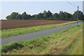
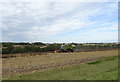
10
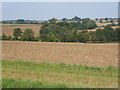
Farmland looking across valley northwest of Hartest
Image: © Andrew Hill
Taken: 20 Sep 2008
0.13 miles