
IMAGES TAKEN NEAR TO
Chadacre Road, BURY ST. EDMUNDS, IP29 4DS
Introduction
This page details the photographs taken nearby to Chadacre Road, IP29 4DS by members of the Geograph project.
The Geograph project started in 2005 with the aim of publishing, organising and preserving representative images for every square kilometre of Great Britain, Ireland and the Isle of Man.

There are currently over 7.5m images from over14,400 individuals and you can help contribute to the project by visiting https://www.geograph.org.uk
Image Map
Images are licensed for reuse under creativecommons.org/licenses/by-sa/2.0
Notes
- Clicking on the map will re-center to the selected point.
- The higher the marker number, the further away the image location is from the centre of the postcode.
Image Listing (10 Images Found)
Images are licensed for reuse under creativecommons.org/licenses/by-sa/2.0
Image
Details
Distance
1
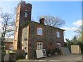
Tower Lodge, under repair
Tower Lodge (not 'Tower Farm', as stated elsewhere on this website) was sold in 2010 for £460.000. It is situated at the end of a concrete track, accessed from the village of Hartest.
Image: © Bob Jones
Taken: 15 Apr 2014
0.02 miles
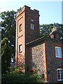
3
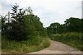
Bridleway to Chadacre Hall
A road, which becomes a byway, and in turn this bridleway, leads from Hartest to Chadacre Hall, Lawshall.
Image: © Bob Jones
Taken: 4 Jul 2006
0.07 miles

5
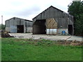
Barns
Barns at Lord's Farm near to Hartest, Suffolk.
Image: © Keith Evans
Taken: 7 Sep 2011
0.16 miles
6
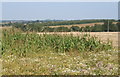
Open farmland northwest of Lord's Farm
The footpath passes to the west of all the farm buildings, as shown on the 1:25,000 map.
Image: © Andrew Hill
Taken: 20 Sep 2008
0.17 miles
7

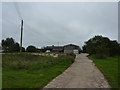
On a track from Tower Lodge
Going towards Jubilee Wood,between Hartest and Shimpling.
Image: © Peter Barr
Taken: 11 Sep 2010
0.19 miles
9
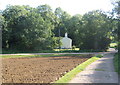
House backed by Jubilee Wood at the edge of Chadacre Park
Image: © Andrew Hill
Taken: 20 Sep 2008
0.22 miles
10

Footpath to Hartest
The path follows the northern edge of this field and leads to a minor road before reaching the village of Hartest.
Image: © Bob Jones
Taken: 15 Apr 2014
0.24 miles