
IMAGES TAKEN NEAR TO
Pembroke Close, IPSWICH, IP2 8PP
Introduction
This page details the photographs taken nearby to Pembroke Close, IP2 8PP by members of the Geograph project.
The Geograph project started in 2005 with the aim of publishing, organising and preserving representative images for every square kilometre of Great Britain, Ireland and the Isle of Man.

There are currently over 7.5m images from over14,400 individuals and you can help contribute to the project by visiting https://www.geograph.org.uk
Image Map
Images are licensed for reuse under creativecommons.org/licenses/by-sa/2.0
Notes
- Clicking on the map will re-center to the selected point.
- The higher the marker number, the further away the image location is from the centre of the postcode.
Image Listing (26 Images Found)
Images are licensed for reuse under creativecommons.org/licenses/by-sa/2.0
Image
Details
Distance


4
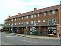
Estate Shops
A small row of shops on Maidenhall Approach Ipswich Suffolk.
Image: © Keith Evans
Taken: 27 Nov 2006
0.16 miles
5
Public footpath at the end of Oak Hill Lane
Image: © Oxymoron
Taken: 10 Jun 2009
0.19 miles
6
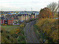
View south-east from above Ipswich Tunnel
Looking towards Orwell Bridge, built high to clear shipping navigating to Ipswich Docks.
Image: © Robin Webster
Taken: 19 Nov 2017
0.19 miles
7
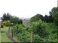
View from mouth of tunnel
Looking out from over the mouth of the railway tunnel south along the Ipswich to Liverpool Street railway line. In the background is the big Orwell Bridge, part of the A14. In the mid 1800s, the railway line from London ended here, hence there is a Station Street nearby which is about half a mile from the current station.
Image: © Trevor Alder
Taken: 14 May 2007
0.20 miles
9
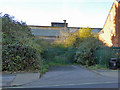
Entrance to former locomotive depot, Ipswich
There was also a works, which lasted for a while after the depot closed. All is now built on, except a fragment that includes the former administration block, which is seen here, boarded up, at least on this side. Why has this been retained? This access is clearly not used, but there is another which is, further along the road.
Image: © Robin Webster
Taken: 19 Nov 2017
0.21 miles
10
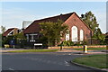
Stoke Green Baptist Church
The church building dates back to 1954 when the estate of Maiden Hall was developed for housing. The church itself has a longer history and is the second oldest baptist church in Suffolk. From 1775 it occupied a building on Wherstead Road where Peppercorn Way is now, although the congregation had been meeting for a few decades before that, originally in Woolverstone.
Image: © Simon Mortimer
Taken: 10 Sep 2020
0.21 miles