
IMAGES TAKEN NEAR TO
Dock Street, IPSWICH, IP2 8EU
Introduction
This page details the photographs taken nearby to Dock Street, IP2 8EU by members of the Geograph project.
The Geograph project started in 2005 with the aim of publishing, organising and preserving representative images for every square kilometre of Great Britain, Ireland and the Isle of Man.

There are currently over 7.5m images from over14,400 individuals and you can help contribute to the project by visiting https://www.geograph.org.uk
Image Map
Images are licensed for reuse under creativecommons.org/licenses/by-sa/2.0
Notes
- Clicking on the map will re-center to the selected point.
- The higher the marker number, the further away the image location is from the centre of the postcode.
Image Listing (530 Images Found)
Images are licensed for reuse under creativecommons.org/licenses/by-sa/2.0
Image
Details
Distance
1
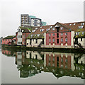
Ipswich: reflections in St Peter's Dock
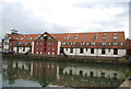
According to the Grade II listing Gipping House is a "late C18 or early C19 warehouse used as infantry barracks in 1803. Converted into maltings in 1849".
Image: © John Sutton
Taken: 25 Jan 2020
0.01 miles
2
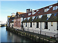
Converted Stoke Bridge Maltings, Ipswich
Looking from Stoke Bridge.
Image: © Robin Webster
Taken: 19 Nov 2017
0.01 miles
3
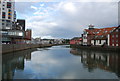
New Cut, River Orwell
The New Cut was made in 1837.
Image: © N Chadwick
Taken: 18 Sep 2011
0.01 miles
5
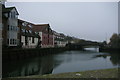
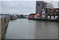
Riverfront housing, south of Stoke Bridge, Ipswich
Stoke Bridge, in the middle distance, is taken as the dividing point between the River Gipping (upstream, the far side of the bridge) and its tidal estuary the River Orwell (this side of the bridge).
Image: © Christopher Hilton
Taken: 16 Nov 2018
0.01 miles
7
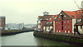
Ipswich IP2, Suffolk.
A row of new-ish, mixed-use developments on the Stokebridge Maltings site on the Stoke side of the River Orwell, as seen from Stoke Bridge.
Image: © David Hallam-Jones
Taken: 28 May 2013
0.02 miles
8
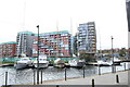
View of boats moored up in Neptune Marina from St. Peter's Dock
Looking south-southwest.
Image: © Robert Lamb
Taken: 6 Nov 2021
0.02 miles
9
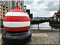
The River Orwell viewed from Stoke Bridge in Ipswich
Image: © Richard Humphrey
Taken: 22 Aug 2021
0.02 miles
10
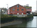
Former maltings, Dock Street, Ipswich
Quoting from http://www.ipswich-lettering.co.uk/edwardfison.html
"Gipping House on Dock Street, which is now the pinkwashed warehouse and offices for a yacht and shipwright company, dates from the late 18th or early 19th century. In its early years it was used as an infantry barracks (as was the nearby Stoke Maltings, see below), but became, in 1849, one of many buildings in the town to be converted into maltings. The lettering on the brickwork at the east end of the premises suggests that, as a maltings, it was owned and operated by Edward Fison Ltd: one of the first British companies to produce malt extract for brewers and bakers."
Image: © Humphrey Bolton
Taken: 14 Feb 2016
0.02 miles