IMAGES TAKEN NEAR TO
Magnolia Close, BURY ST. EDMUNDS, IP28 8SX
Introduction
This page details the photographs taken nearby to Magnolia Close, IP28 8SX by members of the Geograph project.
The Geograph project started in 2005 with the aim of publishing, organising and preserving representative images for every square kilometre of Great Britain, Ireland and the Isle of Man.

There are currently over 7.5m images from over14,400 individuals and you can help contribute to the project by visiting https://www.geograph.org.uk
Image Map
Images are licensed for reuse under creativecommons.org/licenses/by-sa/2.0
Notes
- Clicking on the map will re-center to the selected point.
- The higher the marker number, the further away the image location is from the centre of the postcode.
Image Listing (9 Images Found)
Images are licensed for reuse under creativecommons.org/licenses/by-sa/2.0
Image
Details
Distance
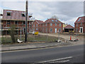
1
New housing, Beck Row
From Rookery Drove.
Image: © Hugh Venables
Taken: 5 May 2012
0.10 miles
2
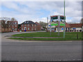
Sycamore Park, Beck Row
New area of houses being built, in the grounds of a former hotel.
Image: © Hugh Venables
Taken: 5 May 2012
0.16 miles
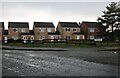
3
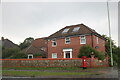
House on the corner of Sycamore Drive and The Street
This was completed in 2011
Image: © David Howard
Taken: 19 Sep 2021
0.17 miles
4
Sycamore Park, Beck Row
New area of houses being built.
Image: © Hugh Venables
Taken: 5 May 2012
0.20 miles
5
Houses under construction, Beck Row
In the grounds of a former hotel.
Image: © Hugh Venables
Taken: 5 May 2012
0.20 miles
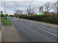
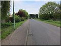
6
Houses on Rookery Drove, Beck Row
From Shippea Hill Road
Image: © David Howard
Taken: 19 Sep 2021
0.20 miles
7
Rookery Drove
On the edge of Beck Row.
Image: © Hugh Venables
Taken: 5 May 2012
0.21 miles
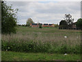
8
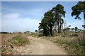
Breach Drove
This track leads from Skeltons Drove to Dingle Farm, north of Beck Row.
Image: © Bob Jones
Taken: 16 Mar 2007
0.24 miles
9
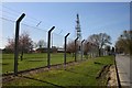
Former entrance to RAF Mildenhall
This road used to be the main entrance to the US Airforce base, but is now blocked off. The fence marks the northern perimeter of the base.
Image: © Bob Jones
Taken: 16 Mar 2007
0.25 miles