IMAGES TAKEN NEAR TO
Yew Tree Gardens, BURY ST. EDMUNDS, IP28 8QR

Introduction

This page details the photographs taken nearby to Yew Tree Gardens, IP28 8QR by members of the Geograph project.

The Geograph project started in 2005 with the aim of publishing, organising and preserving representative images for every square kilometre of Great Britain, Ireland and the Isle of Man.

There are currently over 7.5m images from over14,400 individuals and you can help contribute to the project by visiting https://www.geograph.org.uk

Image Map


Images are licensed for reuse under creativecommons.org/licenses/by-sa/2.0
Notes
  • Clicking on the map will re-center to the selected point.
  • The higher the marker number, the further away the image location is from the centre of the postcode.

Image Listing (24 Images Found)

Images are licensed for reuse under creativecommons.org/licenses/by-sa/2.0
  • ...
Image
Details
Distance
1
Eldo Road, West Row
Image: © Hugh Venables Taken: 9 May 2010
0.02 miles
2
Church Road, West Row
Image: © Hugh Venables Taken: 9 May 2010
0.11 miles
3
Ferry Lane, West Row
Image: © JThomas Taken: 8 May 2012
0.16 miles
4
Farmland, West Row
Image: © JThomas Taken: 8 May 2012
0.19 miles
5
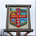
West Row village sign
Down the centre, top to bottom are the crests of Edward the Confessor; Diocese of Ely, the Barton family; the North family, the Hanmer family and the Bunbury family, all having had close links with Mildenhall. In the quarters (from top left, clockwise) a threshing scene symbolic of the agricultural history of the area. A boating scene on the River Lark which runs through the village. An aircraft for the close ties with the Mildenhall airfield with poppies to remember those lost in conflict. Finally the Mildenhall Treasure, a major hoard of highly decorated Roman silver tableware from the fourth-century, which was discovered in West Row.
Image: © Adrian S Pye Taken: 2 Mar 2021
0.19 miles
6
West Row village sign
West Row is a hamlet of Mildenhall
Image: © Adrian S Pye Taken: 25 Sep 2007
0.19 miles
7
Village green and war memorial in West Row
St Peter's Church is in the trees behind.
Image: © Bill Boaden Taken: 22 Apr 2015
0.20 miles
8
Track to Bargate Farm
Image: © JThomas Taken: 8 May 2012
0.20 miles
9
West Row War Memorial and village sign
The Memorial stands directly opposite the church on a small triangular green with the village sign in the background. The memorial bears 35 names from WW1 and eight from WW2.
Image: © Adrian S Pye Taken: 19 Apr 2016
0.20 miles
10
West Row village centre
Village sign on the green, with church behind.
Image: © Bob Jones Taken: 4 Dec 2006
0.20 miles
  • ...