IMAGES TAKEN NEAR TO
Mildenhall Road, BURY ST. EDMUNDS, IP28 8NT
Introduction
This page details the photographs taken nearby to Mildenhall Road, IP28 8NT by members of the Geograph project.
The Geograph project started in 2005 with the aim of publishing, organising and preserving representative images for every square kilometre of Great Britain, Ireland and the Isle of Man.

There are currently over 7.5m images from over14,400 individuals and you can help contribute to the project by visiting https://www.geograph.org.uk
Image Map
Images are licensed for reuse under creativecommons.org/licenses/by-sa/2.0
Notes
- Clicking on the map will re-center to the selected point.
- The higher the marker number, the further away the image location is from the centre of the postcode.
Image Listing (13 Images Found)
Images are licensed for reuse under creativecommons.org/licenses/by-sa/2.0
Image
Details
Distance
1
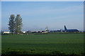
Farmland by RAF Mildenhall
The airbase beyond is used primarily for supply and logistics.
Image: © Bill Boaden
Taken: 22 Apr 2015
0.07 miles
2
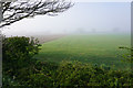
Farmland near RAF Mildenhall
Looking from Mildenhall Road towards Chapel Road on a misty morning.
Image: © Bill Boaden
Taken: 22 Apr 2015
0.11 miles
4
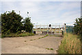
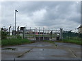
Disused entrance to RAF Mildenhall
This gateway, leading north from the Mildenhall Road, is no longer used.
Image: © Bob Jones
Taken: 31 Jul 2009
0.11 miles
5
Farmland opposite Plantation Farm
The morning mist is clearing away with the strength of the sun.
Image: © Bill Boaden
Taken: 22 Apr 2015
0.12 miles
6
Farmland by Mildenhall Road
Viewed in morning mist.
Image: © Bill Boaden
Taken: 22 Apr 2015
0.13 miles
7
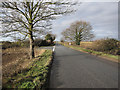
Chapel Road
Junction with Pott Hall Road.
Image: © Hugh Venables
Taken: 17 Jan 2010
0.15 miles
8
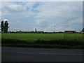
Southern edge of RAF Mildenhall
A KC135 refuelling tanker (similar to the Boeing 707 airliner) sits amongst the maintenance buildings at the 'back' of the USAF airbase, its engines cocooned for protection. On the original photo the refuelling boom is visible at the rear. Despite appearances there is a serious security fence.
Image: © John Goldsmith
Taken: 15 May 2009
0.16 miles