
IMAGES TAKEN NEAR TO
Beverley Close, BURY ST. EDMUNDS, IP28 8BF
Introduction
This page details the photographs taken nearby to Beverley Close, IP28 8BF by members of the Geograph project.
The Geograph project started in 2005 with the aim of publishing, organising and preserving representative images for every square kilometre of Great Britain, Ireland and the Isle of Man.

There are currently over 7.5m images from over14,400 individuals and you can help contribute to the project by visiting https://www.geograph.org.uk
Image Map
Images are licensed for reuse under creativecommons.org/licenses/by-sa/2.0
Notes
- Clicking on the map will re-center to the selected point.
- The higher the marker number, the further away the image location is from the centre of the postcode.
Image Listing (18 Images Found)
Images are licensed for reuse under creativecommons.org/licenses/by-sa/2.0
Image
Details
Distance
3
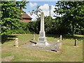
Beck Row, Holywell Row and Wilde Street War Memorial
The three-hamlet Memorial bears the names of 24 men lost in WW1; a further 8 in WW2 and the name of 1 civilian.
Image: © Adrian S Pye
Taken: 26 May 2015
0.06 miles
4
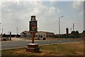
Village sign and control tower
The village of Beck Row is adjacent to the huge US Airforce base at RAF Mildenhall. Behind the village sign are various airfield buildings and an old control tower.
Image: © Bob Jones
Taken: 25 Jul 2006
0.13 miles
5
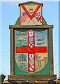
Beck Row village sign
The motif at the top replaces a clock which proved too inaccurate, featuring a Union Jack flag next to the US Stars and Stripes symbolizes the close partnership that has developed between the base and the local community in the 60 years the U.S. Airforce has been at RAF Mildenhall. The main sign takes the form of a quartered shield showing sheep beside the beck, three different types of aircraft, all of which have flown from Mildenhall airbase. In the lower quarters, an oak tree with acorns, and finally a farm labourer gathers sheaves to make stooks ready for collection.
https://www.geograph.org.uk/photo/4291308
Image: © Adrian S Pye
Taken: 31 Jan 2020
0.13 miles
6
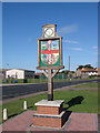
Beck Row village sign
Beck Row is actually a hamlet of Mildenhall, part of the airbase of which can be seen in the background.
The motif featuring a Union Jack flag next to the US Stars and Stripes symbolizes the close partnership that has developed between the base and the local community in the 60 years the U.S. Airforce has been at RAF Mildenhall. The main sign takes the form of a quartered shield showing sheep beside the beck, three different types of aircraft, all of which have flown from Mildenhall airbase. In the lower quarters, an oak tree with acorns, and finally a farm labourer gathers sheaves to make stooks ready for collection.
https://www.geograph.org.uk/photo/6745639
Image: © Adrian S Pye
Taken: 25 Sep 2007
0.13 miles
7
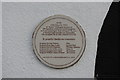
In remembrance of the crew of a Wellington R1474 OJ-M
The text on the plaque is self explanatory.
The bungalow to which it is affixed can be seen here > https://www.geograph.org.uk/photo/6379943
Image: © Adrian S Pye
Taken: 31 Jan 2020
0.15 miles
8
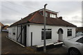
Bungalow with history
There is a circular plaque by the front door which tells the story https://www.geograph.org.uk/photo/6379939
Image: © Adrian S Pye
Taken: 31 Jan 2020
0.15 miles
9
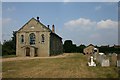
Former Methodist Church, Beck Row
Three churches in one: the sign on the main building says 'Methodist Church', but this clearly has been overlaid on top of 'Wesleyan Chapel'. The smaller building to the right is the only one in use, as the Christian Science Church.
Image: © Bob Jones
Taken: 25 Jul 2006
0.16 miles
10
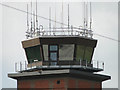
Control tower at Mildenhall bristling with antenna
Image: © Adrian S Pye
Taken: 26 May 2015
0.20 miles