
IMAGES TAKEN NEAR TO
The Farthings, BURY ST. EDMUNDS, IP28 6PE
Introduction
This page details the photographs taken nearby to The Farthings, IP28 6PE by members of the Geograph project.
The Geograph project started in 2005 with the aim of publishing, organising and preserving representative images for every square kilometre of Great Britain, Ireland and the Isle of Man.

There are currently over 7.5m images from over14,400 individuals and you can help contribute to the project by visiting https://www.geograph.org.uk
Image Map
Images are licensed for reuse under creativecommons.org/licenses/by-sa/2.0
Notes
- Clicking on the map will re-center to the selected point.
- The higher the marker number, the further away the image location is from the centre of the postcode.
Image Listing (44 Images Found)
Images are licensed for reuse under creativecommons.org/licenses/by-sa/2.0
Image
Details
Distance
4
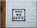
Old Sign
Old sign from the days of Mildenhall Rural District Water Works seen on a cottage http://www.geograph.org.uk/photo/2691007 at Icklingham, Suffolk.
Image: © Keith Evans
Taken: 10 Nov 2011
0.07 miles
5
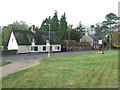
Old Cottages
Old cottages opposite the church at Icklingham, Suffolk the cottage has an old water valve or fire hydrant sign on see http://www.geograph.org.uk/photo/2691009 from the old Mildenhall Rural District Water Works.
Image: © Keith Evans
Taken: 10 Nov 2011
0.07 miles
6
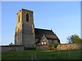
All Saints, Icklingham (Anglican, Redundant)
This thatched church was declared redundant in the 1970's and is now cared for by the Churches Conservation Trust
Image: © Stuart Shepherd
Taken: 23 Apr 2009
0.08 miles
7
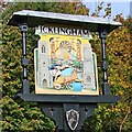
Icklingham village sign (detail)
Icklingham sign has two churches, All Saints which is close to the sign, redundant and is in the care of the Churches Conservation Trust, and St James about 700 yards along the A1101. The two parishes virtually are merged into one. Between the church towers are, at the top two Roman soldiers guarding a water mill. The road through the village was certainly Roman, although it does wiggle a bit these days. Beneath them is an Iceni warrior in his chariot, and one of his kind was probably the origin of the parish name. https://www.geograph.org.uk/photo/4293128
Image: © Adrian S Pye
Taken: 12 Oct 2008
0.08 miles
8
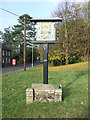
Village Sign
Village sign at Icklingham, Suffolk.
Image: © Keith Evans
Taken: 10 Nov 2011
0.08 miles
9
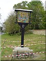
Icklingham village sign
The base is sinking into the sandy ground and is being stabilised.
Icklingham sign has two churches, All Saints which is close to the sign, redundant and is in the care of the Churches Conservation Trust, and St James about 700 yards along the A1101. Between the church towers are, at the top two Roman soldiers guarding a water mill. The road through the village was certainly Roman, although it does wiggle a bit these days. Beneath them is an Iceni warrior in his chariot, and one of his kind was probably the origin of the parish name. https://www.geograph.org.uk/photo/6764076
Image: © Adrian S Pye
Taken: 22 Apr 2007
0.08 miles
10
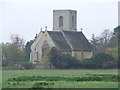
All Saints Icklingham
The church of All Saints Icklingham, Suffolk. For more info see http://www.suffolkchurches.co.uk/icklinga.html and other views see http://www.geograph.org.uk/photo/2690985 http://www.geograph.org.uk/photo/2690973
Image: © Keith Evans
Taken: 10 Nov 2011
0.08 miles