IMAGES TAKEN NEAR TO
The Street, BURY ST. EDMUNDS, IP28 6DN
Introduction
This page details the photographs taken nearby to The Street, IP28 6DN by members of the Geograph project.
The Geograph project started in 2005 with the aim of publishing, organising and preserving representative images for every square kilometre of Great Britain, Ireland and the Isle of Man.

There are currently over 7.5m images from over14,400 individuals and you can help contribute to the project by visiting https://www.geograph.org.uk
Image Map
Images are licensed for reuse under creativecommons.org/licenses/by-sa/2.0
Notes
- Clicking on the map will re-center to the selected point.
- The higher the marker number, the further away the image location is from the centre of the postcode.
Image Listing (10 Images Found)
Images are licensed for reuse under creativecommons.org/licenses/by-sa/2.0
Image
Details
Distance
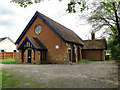
2
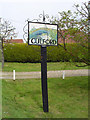
Culford village sign
Culford Hall is featured on one side and The Iron Bridge on the other. The hall which was rebuilt in 1796 for the Cornwallis family and is central to the Culford Estate. It is now The Culford School after being sold by the 7th Earl Cadogan in 1935. The Iron Bridge spans the estate’s lake, west of the hall. It was constructed in 1804, designed by Samuel Wyatt and is and is made of five tubular cast-iron sections repeated six times form the 60ft span, supported on channelled granite abutments. It is the largest of the eight surviving cast iron bridges built between 1790 - 1810. The castings were produced in Gateshead at a cost of £1,457. It received a grade I listing in 1996. https://www.geograph.org.uk/photo/4466848
Image: © Adrian S Pye
Taken: 25 Aug 2008
0.02 miles
3
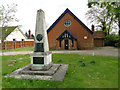
Culford War Memorial and village hall
There are 11 names for Culford and the Memorial also incorporates the parishes of Wordwell (no names), West Stow (1 name) and Ingham (11 names).
Culford also has the names of a further nine names for WW2.
Image: © Adrian S Pye
Taken: 8 May 2015
0.02 miles
4
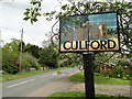
Culford village sign (detail)
Culford Hall is featured on one side and The Iron Bridge on the other. The hall which was rebuilt in 1796 for the Cornwallis family and is central to the Culford Estate. It is now The Culford School after being sold by the 7th Earl Cadogan in 1935. The Iron Bridge spans the estate’s lake, west of the hall. It was constructed in 1804, designed by Samuel Wyatt and is and is made of five tubular cast-iron sections repeated six times form the 60ft span, supported on channelled granite abutments. It is the largest of the eight surviving cast iron bridges built between 1790 - 1810. The castings were produced in Gateshead at a cost of £1,457. It received a grade I listing in 1996. https://www.geograph.org.uk/photo/4291599
Image: © Adrian S Pye
Taken: 8 May 2015
0.02 miles
5
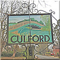
Culford village sign (bridge)
Culford Hall is featured on one side and The Iron Bridge on the other. The hall which was rebuilt in 1796 for the Cornwallis family and is central to the Culford Estate. It is now The Culford School after being sold by the 7th Earl Cadogan in 1935. The Iron Bridge spans the estate’s lake, west of the hall. It was constructed in 1804, designed by Samuel Wyatt and is and is made of five tubular cast-iron sections repeated six times form the 60ft span, supported on channelled granite abutments. It is the largest of the eight surviving cast iron bridges built between 1790 - 1810. The castings were produced in Gateshead at a cost of £1,457. It received a grade I listing in 1996.
Image: © Adrian S Pye
Taken: 2 Mar 2021
0.02 miles

7
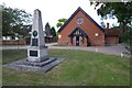
Culford War Memorial
Culford War Memorial and village Hall.
Image: © Philip Halling
Taken: 28 Jun 2022
0.02 miles
9
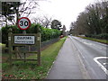
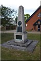
Entering Culford
Entering Culford, Suffolk on the B1106.
Image: © Keith Evans
Taken: 5 Jan 2012
0.10 miles