IMAGES TAKEN NEAR TO
Grange Lane, BURY ST. EDMUNDS, IP28 6AZ

Introduction

This page details the photographs taken nearby to Grange Lane, IP28 6AZ by members of the Geograph project.

The Geograph project started in 2005 with the aim of publishing, organising and preserving representative images for every square kilometre of Great Britain, Ireland and the Isle of Man.

There are currently over 7.5m images from over14,400 individuals and you can help contribute to the project by visiting https://www.geograph.org.uk

Image Map


Images are licensed for reuse under creativecommons.org/licenses/by-sa/2.0
Notes
  • Clicking on the map will re-center to the selected point.
  • The higher the marker number, the further away the image location is from the centre of the postcode.

Image Listing (48 Images Found)

Images are licensed for reuse under creativecommons.org/licenses/by-sa/2.0
  • ...
Image
Details
Distance
1
Recreation ground in Barton Mills
Image: © David Howard Taken: 18 Apr 2021
0.11 miles
2
Mildenhall Road, Barton Mills
Image: © David Howard Taken: 18 Apr 2021
0.12 miles
3
Barton Mills village hall
I have put this in the suburb category, as although it was a village at the time it is now more of a suburb of Mildenhall, being less than a mile away.
Image: © David Howard Taken: 18 Apr 2021
0.14 miles
4
House and rose bush in Barton Mills
Image: © David Howard Taken: 6 Jul 2021
0.15 miles
5
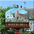
Barton Mills village sign
In common with many villages in East Anglia, Barton Mills has a village sign depicting aspects of local life or history.
Image: © Stephen McKay Taken: 15 Dec 2012
0.16 miles
6
Barton Mills village sign
Image: © Adrian S Pye Taken: 28 Jul 2007
0.16 miles
7
Barton Mills village sign
Image: © David Howard Taken: 18 Apr 2021
0.16 miles
8
Field by Newmarket Road, Barton Mills
Image: © David Howard Taken: 18 Apr 2021
0.17 miles
9
The Street at the corner of Church Lane
Image: © David Howard Taken: 18 Apr 2021
0.17 miles
10
Barton Mills village sign
Barton Mills is a name first used in the 18th century, previously called Barton Parva. Depicted on the sign is the water mill which is on the River Lark on the border with Mildenhall. The church of St Mary is shown with a scarecrow, relating to the bi-annual scarecrow festival held in the village. The record number of scarecrows is 760, only broken by the National Forest Adventure Farm near Burton on Trent. https://www.geograph.org.uk/photo/4291306
Image: © Adrian S Pye Taken: 28 Jun 2007
0.18 miles
  • ...