IMAGES TAKEN NEAR TO
Mutford Green, BRANDON, IP27 9LR
Introduction
This page details the photographs taken nearby to Mutford Green, IP27 9LR by members of the Geograph project.
The Geograph project started in 2005 with the aim of publishing, organising and preserving representative images for every square kilometre of Great Britain, Ireland and the Isle of Man.

There are currently over 7.5m images from over14,400 individuals and you can help contribute to the project by visiting https://www.geograph.org.uk
Image Map
Images are licensed for reuse under creativecommons.org/licenses/by-sa/2.0
Notes
- Clicking on the map will re-center to the selected point.
- The higher the marker number, the further away the image location is from the centre of the postcode.
Image Listing (21 Images Found)
Images are licensed for reuse under creativecommons.org/licenses/by-sa/2.0
Image
Details
Distance
1
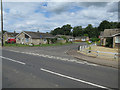
Bungalows about to go
Boarded u and fenced off.
Image: © Hugh Venables
Taken: 24 Jul 2016
0.03 miles
2
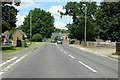
B1112 High Street, Lakenheath
North of the centre.
Image: © Robin Webster
Taken: 12 Jul 2020
0.05 miles
4

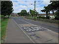
Cut-Off Channel near Lakenheath
The Cut-Off Channel follows the eastern edge of the Fens. Here it marks a fairly sharp boundary between the fertile, peaty Fens and the sandier Brecks. This isn't a change in the underlying sediments but the Fens are lower and flooded, creating a peat layer above the mostly undisturbed sand and gravel. In the Brecks the sand and gravel deposits haven't been covered and have been worked into the soil. In some areas it is infertile heathland or woodland while in other areas it is excellent for root vegetables.
Image: © Hugh Venables
Taken: 24 Jul 2016
0.06 miles
5
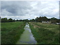
Cut-Off Channel near Lakenheath
Looking north from the bridge on Highbridge Gravel Drove.
Image: © JThomas
Taken: 19 Aug 2017
0.06 miles
6
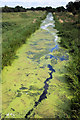
Cut-off Channel, near Lakenheath
The Cut-off Channel links the River Lark near Mildenhall, with the tidal river Great Ouse at Denver Sluice, via the Relief Channel. At times of flood it takes waters from the Lark, Little Ouse and Wissey rivers. At other times it is a quiet, weed-infested and near-stagnant waterway that skirts the eastern edge of the Fens. The channel was completed in 1964.
Image: © Bob Jones
Taken: 11 Aug 2009
0.07 miles
7
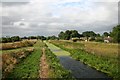
Cut-off Channel, near Lakenheath
The Cut-off Channel crosses Grime Fen, as viewed from Highbridge Gravel Drove. This drainage channel takes flood waters from the Lark, Little Ouse and Wissey rivers. The channel was completed in 1964.
Image: © Bob Jones
Taken: 7 Aug 2006
0.08 miles
8
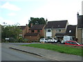
Houses off Highbridge Gravel Drove, Lakenheath
Image: © JThomas
Taken: 19 Aug 2017
0.08 miles