
IMAGES TAKEN NEAR TO
The Cedars, BRANDON, IP27 9HG
Introduction
This page details the photographs taken nearby to The Cedars, IP27 9HG by members of the Geograph project.
The Geograph project started in 2005 with the aim of publishing, organising and preserving representative images for every square kilometre of Great Britain, Ireland and the Isle of Man.

There are currently over 7.5m images from over14,400 individuals and you can help contribute to the project by visiting https://www.geograph.org.uk
Image Map
Images are licensed for reuse under creativecommons.org/licenses/by-sa/2.0
Notes
- Clicking on the map will re-center to the selected point.
- The higher the marker number, the further away the image location is from the centre of the postcode.
Image Listing (5 Images Found)
Images are licensed for reuse under creativecommons.org/licenses/by-sa/2.0
Image
Details
Distance
1
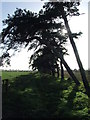
Trees Path And Sunshine
Winter sunshine trees and footpath near to Lakenheath.
Image: © Keith Evans
Taken: 25 Nov 2015
0.12 miles
2
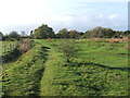
Near The Trig Point
Footpath on Maidcross Hill with its trig point just to the centre of the picture near to Lakenheath.
Image: © Keith Evans
Taken: 25 Nov 2015
0.25 miles
3
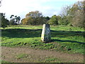
31 metres above sea level
The trig point at Maidcross Hill near to Lakenheath, Suffolk.
Image: © Keith Evans
Taken: 25 Nov 2015
0.25 miles
4
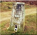
Trigpoint Pillar OSBM 11145 Maids Cross Hill
Maids Cross Hill is close to RAF Lakenheath and is accessible from Broom Road. The Trig Point is a pillar style marker of the Secondary Order, it is now a passive station forming part of the OS GPS network. It has a Flush Bracket with the number OSBM 11145. An OS GPS plate is located on the station dated July 1999.
Image: © Cud05
Taken: 19 Mar 2016
0.25 miles
5
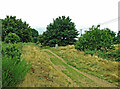
The trig point on Maidscross Hill
This used to be a good viewing point for Lakenheath Airfield but growth of vegetation now obscures the line of sight. Visited in disappointing summer weather.
Image: © Mary and Angus Hogg
Taken: 31 Aug 2021
0.25 miles