IMAGES TAKEN NEAR TO
Sandgalls Drive, BRANDON, IP27 9EG

Introduction

This page details the photographs taken nearby to Sandgalls Drive, IP27 9EG by members of the Geograph project.

The Geograph project started in 2005 with the aim of publishing, organising and preserving representative images for every square kilometre of Great Britain, Ireland and the Isle of Man.

There are currently over 7.5m images from over14,400 individuals and you can help contribute to the project by visiting https://www.geograph.org.uk

Image Map


Images are licensed for reuse under creativecommons.org/licenses/by-sa/2.0
Notes
  • Clicking on the map will re-center to the selected point.
  • The higher the marker number, the further away the image location is from the centre of the postcode.

Image Listing (6 Images Found)

Images are licensed for reuse under creativecommons.org/licenses/by-sa/2.0
Image
Details
Distance
1
Trees Path And Sunshine
Winter sunshine trees and footpath near to Lakenheath.
Image: © Keith Evans Taken: 25 Nov 2015
0.18 miles
2
Postbox at Lakenheath
Royal Mail list this box as 'IP27 17 Cemetary Road'. The spelling error is theirs!
Image: © David Bremner Taken: 1 Nov 2022
0.22 miles
3
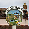
Lakenheath village sign
The sign depicts of a number of features in the village including a bittern hidden in the reeds, along with the golden oriole whose only breeding site in the UK is at Lakenheath Fen. The church of St. Mary which is reflected in the fishing pond. Flying over some of the old flint houses is a Stirling bomber which flew from the airfield during WWII. Even the War Memorial is featured. https://www.geograph.org.uk/photo/6663347
Image: © Adrian S Pye Taken: 3 Nov 2020
0.23 miles
4
CJ's Sandwich Bar
On the High Street, Lakenheath.
Image: © Hugh Venables Taken: 24 Jul 2016
0.23 miles
5
Lakenheath village sign on the High Street
The sign depicts of a number of features in the village including a bittern hidden in the reeds, along with the golden oriole whose only breeding site in the UK is at Lakenheath Fen. The church of St. Mary which is reflected in the fishing pond. Flying over some of the old flint houses is a Stirling bomber which flew from the airfield during WWII. Even the War Memorial is featured. https://www.geograph.org.uk/photo/6663346
Image: © Adrian S Pye Taken: 3 Nov 2020
0.24 miles
6
Small green on High Street, Lakenheath
Image: © David Howard Taken: 6 Jul 2021
0.24 miles