
IMAGES TAKEN NEAR TO
Jubilee Close, BRANDON, IP27 0RJ
Introduction
This page details the photographs taken nearby to Jubilee Close, IP27 0RJ by members of the Geograph project.
The Geograph project started in 2005 with the aim of publishing, organising and preserving representative images for every square kilometre of Great Britain, Ireland and the Isle of Man.

There are currently over 7.5m images from over14,400 individuals and you can help contribute to the project by visiting https://www.geograph.org.uk
Image Map
Images are licensed for reuse under creativecommons.org/licenses/by-sa/2.0
Notes
- Clicking on the map will re-center to the selected point.
- The higher the marker number, the further away the image location is from the centre of the postcode.
Image Listing (22 Images Found)
Images are licensed for reuse under creativecommons.org/licenses/by-sa/2.0
Image
Details
Distance
1
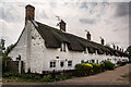
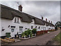
The Row, Weeting
One of the longest continuous lines of thatched roofed houses in the UK.
Grade II Listed.
Terrace of 10 dwellings. C18 and C19. Colourwashed brick with continuous thatched roof. One and a half storeys. 2-light casements and doorways beneath segmental arches. 10 eyebrow dormers to facade and approximately 20 gabled dormers to rear. Gable-end stacks and 6 axial stacks. Continuous outshut to rear.
Image: © Brian Deegan
Taken: 18 Jun 2023
0.04 miles
3

Weeting village sign
The village of Weeting has a castle but it is not included on the sign, instead a stone curlew and a rabbit with the thatched cottages called The Row in the background. The ten terraced cottages are believed to be the longest row of thatched cottages in England. https://www.geograph.org.uk/photo/919170 The coat of arms if for J J Angerstein a philanthropist and landowner whose family lived at Weeting Hall until 1901. Each side of the arms are fir twigs and cones in deference to the nature of the surrounding woodland.
On each facet of the pedestal are ceramic plaques illustrating a Neolithic man mining flint; the castle ruins, the church and a sheep; pilgrims who passed this way on their journey to Walsingham and a thatcher with a some bundles on his shoulder. https://www.geograph.org.uk/photo/6791042
Image: © Adrian S Pye
Taken: 29 Mar 2021
0.06 miles
4
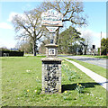
Weeting village sign
The village of Weeting has a castle but it is not included on the sign, instead a stone curlew and a rabbit with the thatched cottages called The Row in the background. The ten terraced cottages are believed to be the longest row of thatched cottages in England. https://www.geograph.org.uk/photo/919170 The coat of arms if for J J Angerstein a philanthropist and landowner whose family lived at Weeting Hall until 1901. Each side of the arms are fir twigs and cones in deference to the nature of the surrounding woodland.
On each facet of the pedestal are ceramic plaques illustrating a Neolithic man mining flint; the castle ruins, the church and a sheep; pilgrims who passed this way on their journey to Walsingham and a thatcher with a some bundles on his shoulder. https://www.geograph.org.uk/photo/6791040
Image: © Adrian S Pye
Taken: 29 Mar 2021
0.06 miles
5

Thatched cottages
These cottages at Weeting in Norfolk were damaged by fire in April 2007 http://news.bbc.co.uk/1/hi/england/norfolk/6539243.stm at the time reported by the press as being the longest line of continuous thatch in Britain. The have since been restored.
Today April 25 2011. Three of these cottage have again been damaged by fire see http://www.bbc.co.uk/news/uk-england-norfolk-13187714
Image: © Keith Evans
Taken: 12 Aug 2008
0.07 miles
7
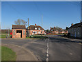
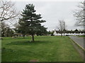
Bus stop, Weeting
At the junction between Park View and South Park.
Image: © Hugh Venables
Taken: 19 Mar 2011
0.10 miles
8
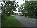
Bend in Hockwold Road, Weeting
Looking north.
Image: © JThomas
Taken: 19 Aug 2017
0.10 miles
9
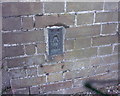
OS Flush Bracket 10993
Weeting.
www.bench-marks.org.uk/bm12758
Image: © Richard Neale
Taken: 1 Nov 2001
0.11 miles
10
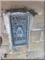
Ordnance Survey Flush Bracket (10993)
This OS Flush Bracket can be found on Walnut Cottage. It marks a point 8.461m above mean sea level.
Image: © Adrian Dust
Taken: 5 Oct 2014
0.11 miles