IMAGES TAKEN NEAR TO
Weeting, BRANDON, IP27 0RA
Introduction
This page details the photographs taken nearby to IP27 0RA by members of the Geograph project.
The Geograph project started in 2005 with the aim of publishing, organising and preserving representative images for every square kilometre of Great Britain, Ireland and the Isle of Man.

There are currently over 7.5m images from over14,400 individuals and you can help contribute to the project by visiting https://www.geograph.org.uk
Image Map
Images are licensed for reuse under creativecommons.org/licenses/by-sa/2.0
Notes
- Clicking on the map will re-center to the selected point.
- The higher the marker number, the further away the image location is from the centre of the postcode.
Image Listing (116 Images Found)
Images are licensed for reuse under creativecommons.org/licenses/by-sa/2.0
Image
Details
Distance
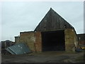
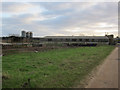
2
Unmetalled road, Weeting
Looking towards Home Farm
Image: © Oxyman
Taken: 20 Mar 2008
0.05 miles
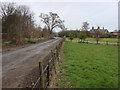
3
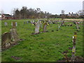
St Mary's church in Weeting - churchyard
View across St Mary's > http://www.geograph.org.uk/photo/1878924 churchyard. Home Farm can be seen in the background.
Image: © Evelyn Simak
Taken: 25 May 2010
0.06 miles
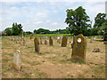
6
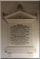
St Mary, Weeting, Norfolk - Wall monument
Image: © John Salmon
Taken: 12 Dec 2009
0.07 miles
7
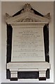
St Mary, Weeting, Norfolk - Wall monument
Image: © John Salmon
Taken: 12 Dec 2009
0.07 miles
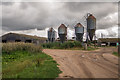
10
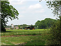
Fields east of St Mary's church, Weeting
For a view of the church see > http://www.geograph.org.uk/photo/1878924. Home Farm can be seen in the background.
Image: © Evelyn Simak
Taken: 25 May 2010
0.08 miles