
IMAGES TAKEN NEAR TO
Hereward Way, BRANDON, IP27 0QN
Introduction
This page details the photographs taken nearby to Hereward Way, IP27 0QN by members of the Geograph project.
The Geograph project started in 2005 with the aim of publishing, organising and preserving representative images for every square kilometre of Great Britain, Ireland and the Isle of Man.

There are currently over 7.5m images from over14,400 individuals and you can help contribute to the project by visiting https://www.geograph.org.uk
Image Map
Images are licensed for reuse under creativecommons.org/licenses/by-sa/2.0
Notes
- Clicking on the map will re-center to the selected point.
- The higher the marker number, the further away the image location is from the centre of the postcode.
Image Listing (24 Images Found)
Images are licensed for reuse under creativecommons.org/licenses/by-sa/2.0
Image
Details
Distance
1

Petrol station, Weeting
Currently BP, previously a Gulf.
Image: © Hugh Venables
Taken: 26 May 2017
0.09 miles
2
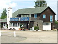
The Saxon
The Saxon public house at Weeting, Norfolk.
Image: © Keith Evans
Taken: 2 Aug 2012
0.09 miles
6
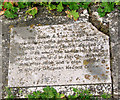
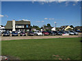
The site of All Saints' church in Weeting - commemorative stone
Nothing but a barely discernible mound > http://www.geograph.org.uk/photo/1878811 and a commemorative stone remain of the church of All Saints which once stood on this site. The church was abandoned in 1739 when its tower collapsed, the graveyard continued to be used for burials up until 1890.
Image: © Evelyn Simak
Taken: 25 May 2010
0.20 miles
7

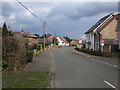
Weeting All Saints church once stood here
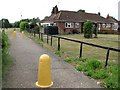
Nothing but a row of headstones, a barely discernible mound and a commemorative stone remains of the church of All Saints Weeting which once stood on this site. The church was abandoned in 1739 when its tower collapsed, the graveyard continued to be used for burials up until 1890. All gravestones were removed from their original places and lined up against the fence of a property on the edge of the consecrated ground and the area is now a playing field and recreation ground. The Village Hall is on the edge of the site. According to Batcock quoting Blomefield, it was originally built in the 14th or 15th c. and had a square tower with diagonal buttresses and south aisle. The nave was about 35 ft long and the chancel 33ft in length but only about 18 ft wide. Attached to the south side of the church was a porch.
Image: © Adrian S Pye
Taken: 28 Aug 2009
0.21 miles
9
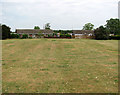
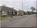
The site of All Saints' church in Weeting
Nothing but a barely discernible mound and a commemorative stone > http://www.geograph.org.uk/photo/1878818 remain of the church of All Saints which once stood on this site. The church was abandoned in 1739 when its tower collapsed, the graveyard continued to be used for burials up until 1890. All gravestones were removed from their original places and lined up against the fence of a property on the edge of the consecrated ground > http://www.geograph.org.uk/photo/1878812.
Image: © Evelyn Simak
Taken: 25 May 2010
0.22 miles
10
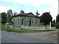
Former Gatehouse
Former gatehouse near to Weeting, Norfolk.
Image: © Keith Evans
Taken: 2 Aug 2012
0.23 miles