IMAGES TAKEN NEAR TO
Rectory Lane, BRANDON, IP27 0PX
Introduction
This page details the photographs taken nearby to Rectory Lane, IP27 0PX by members of the Geograph project.
The Geograph project started in 2005 with the aim of publishing, organising and preserving representative images for every square kilometre of Great Britain, Ireland and the Isle of Man.

There are currently over 7.5m images from over14,400 individuals and you can help contribute to the project by visiting https://www.geograph.org.uk
Image Map
Images are licensed for reuse under creativecommons.org/licenses/by-sa/2.0
Notes
- Clicking on the map will re-center to the selected point.
- The higher the marker number, the further away the image location is from the centre of the postcode.
Image Listing (8 Images Found)
Images are licensed for reuse under creativecommons.org/licenses/by-sa/2.0
Image
Details
Distance
1
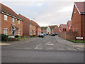
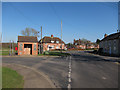
Victor Charles Close, Weeting
New housing in the village, the three closest houses on the right are even more recent than the others, replacing an older house on South Park road.
Image: © Hugh Venables
Taken: 7 Jan 2012
0.07 miles
2
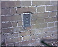
OS Flush Bracket 10993
Weeting.
www.bench-marks.org.uk/bm12758
Image: © Richard Neale
Taken: 1 Nov 2001
0.12 miles
3
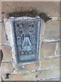
Ordnance Survey Flush Bracket (10993)
This OS Flush Bracket can be found on Walnut Cottage. It marks a point 8.461m above mean sea level.
Image: © Adrian Dust
Taken: 5 Oct 2014
0.12 miles
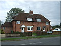
5
Bus stop, Weeting
At the junction between Park View and South Park.
Image: © Hugh Venables
Taken: 19 Mar 2011
0.13 miles
6
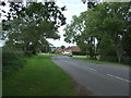
Bend in Hockwold Road, Weeting
Looking north.
Image: © JThomas
Taken: 19 Aug 2017
0.22 miles
7
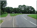
Bend In Road
Bend on the Hockwold Road at Weeting, Norfolk.
Image: © Keith Evans
Taken: 2 Aug 2012
0.23 miles
8
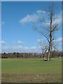
Winter Tree Blue Sky
Trees still in their winter hibernation with clear blue spring skies near to Weeting, Norfolk.
Image: © Keith Evans
Taken: 9 Mar 2007
0.24 miles